
Archuleta County · San Juan Mountains
Pagosa Springs, Colorado
In downtown Pagosa Springs, steam rises from mineral pools beside the San Juan River. Spend a morning soaking, follow Pagosa Street for lunch, or head east to ski Wolf Creek. West of town, twin sandstone spires mark Chimney Rock, an ancestral Pueblo site. During flood recovery, check road, trail and river access before setting out. Current local access updates
Saved in this browser.


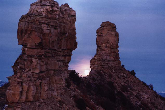
Photo credits
- Pagosa springs panorama · Gmhatfield · Public domain
- Wolf Creek Pass and Ski Area · Doc Searls · CC BY-SA 2.0
- Chimney Rock Colorado · U.S. Department of Agriculture · Public domain
- County
- Archuleta CountySouthwest Colorado
- Town elevation
- About 7,100 feetHigher terrain on Wolf Creek Pass
- River
- San Juan RiverRuns through downtown
- Highways
- US 160 & US 84Wolf Creek Pass to the east
Choose your stops
Fun things to do in Pagosa Springs, Colorado
Pick a soak, a slope or a stop along US 160. Open a card for the details and save your favorites to your travel list.
 All year
The Springs Resort
Choose a day pass or stay overnight beside the Mother Spring. The resort’s November 20 update lists the bathhouse, saunas, wellness pools and a portion of the general admission pools as open.
Check the pool list before booking, especially if a particular pool or accessible entry is important to your visit.
Plan your visit Summer
Pagosa Springs History Museum
Look for the museum at 96 Pagosa Street, beside the bridge at the east end of downtown. Its exhibits give the surrounding ranches, old photographs and logging roads a local history.
The museum publishes a Memorial Day to Labor Day season. Check hours before making a special trip.
Plan your visit Winter
Wolf Creek Ski Area
US 160 climbs east out of town toward the Continental Divide. Wolf Creek resumed daily operations for the 2026/27 season on November 21.
Check the mountain report for open terrain, lessons and rentals. Check COtrip separately for the drive over the pass.
Plan your visit Summer / Fall
Treasure Falls
The waterfall sits below the switchbacks on the west side of Wolf Creek Pass. It makes a natural stop on the road from South Fork when the pullout and trail are open.
A reopened highway does not establish trail access. Check the Pagosa Ranger District’s current restrictions before including the walk.
Plan your visit Summer / Fall
Chimney Rock National Monument
West of Pagosa Springs, take CO 151 to the monument entrance. Explore ancestral Pueblo settlements on the mesa with an interpretive guide or on a self-guided visit in season.
Choose the accessible Mesa Village Trail for the lower archaeological sites. The upper Great House route has uneven ground and seasonal wildlife restrictions.
Plan your visit All year
Downtown river district
Start with the shops and cafés along Pagosa Street. From an open street crossing, look across the river toward the hot springs and the forested shoulder of Reservoir Hill.
Flood repairs affect riverbanks, bridges and paths. Ask the visitor center which blocks and crossings are open before planning a walking loop.
Plan your visit All year
The Mother Spring
See the source of the mineral water that feeds the town’s bathhouses. The contrast is easiest to see on a cool morning when steam hangs above the water.
Ask the resort about current viewing access. Book a developed pool for bathing.
Plan your visit All year
Pagosa Street walking tour
Use the visitor bureau’s downtown walking map to find local landmarks, shops and the old courthouse district. The short blocks make it easy to choose just one part of the route.
During repairs, ask which sidewalks and bridges are open before setting out from the community center.
Plan your visit All year
Wolf Creek Pass scenic drive
US 160 links the San Juan valley with South Fork over the Continental Divide. The steep west approach gives a very different view of the mountains than the highway through town.
Use only open, signed pullouts. Through travel resumed November 21, 2026. The highway, viewpoints and forest roads have separate access rules.
Plan your visitYour selections are saved in this browser.
Photo credits
- Pagosa Hot Springs, soaking pools on the San Juan River · Netherzone · CC BY-SA 4.0
- Pagosa Springs Museum · Netherzone · CC BY-SA 4.0
- Wolf Creek Ski Area · Jeffrey Beall · CC BY 4.0
- Treasure Falls, Colorado · Ahodges7 · CC BY-SA 3.0
- Chimney Rock National Monument · Jeffrey Beall · CC BY 3.0
- Pagosa Hot Springs – looking west from Hot Springs Blvd · Netherzone · CC BY-SA 4.0
- Pagosa Hot Spring · Netherzone · CC BY-SA 4.0
- Archuleta County Courthouse · Jeffrey Beall · CC BY 4.0
- WolfCreekSkiArea, aerialview · Doc Searls · CC BY-SA 2.0
Add something to your trip
Upcoming events in Pagosa Springs
Browse the next 30 days or open the monthly calendar. Times are local. Select an event for tickets, meeting points and schedule changes.
Pagosa Springs festivals & annual events
Hot Springs Fest returns in December, followed by WinterFest in January. The summer and fall cards identify the usual season until organizers release their 2027 schedules.
 Dec 11–13, 2026Hot Springs Fest
 Spring · 2027 dates pendingPints, Pools & PaddlesJan 15–17, 2027WinterFest
 Summer · 2027 dates pendingPagosa Springs Car Show
 Independence Day season · dates pendingPark to Park Artisan & Food Market
 Independence Day season · dates pendingRed Ryder Roundup RodeoSummer · 2027 dates pendingArchuleta County FairFall · 2027 dates pendingColorFestColorFest weekend · dates pendingPassport to Pagosa Wine & Food Festival
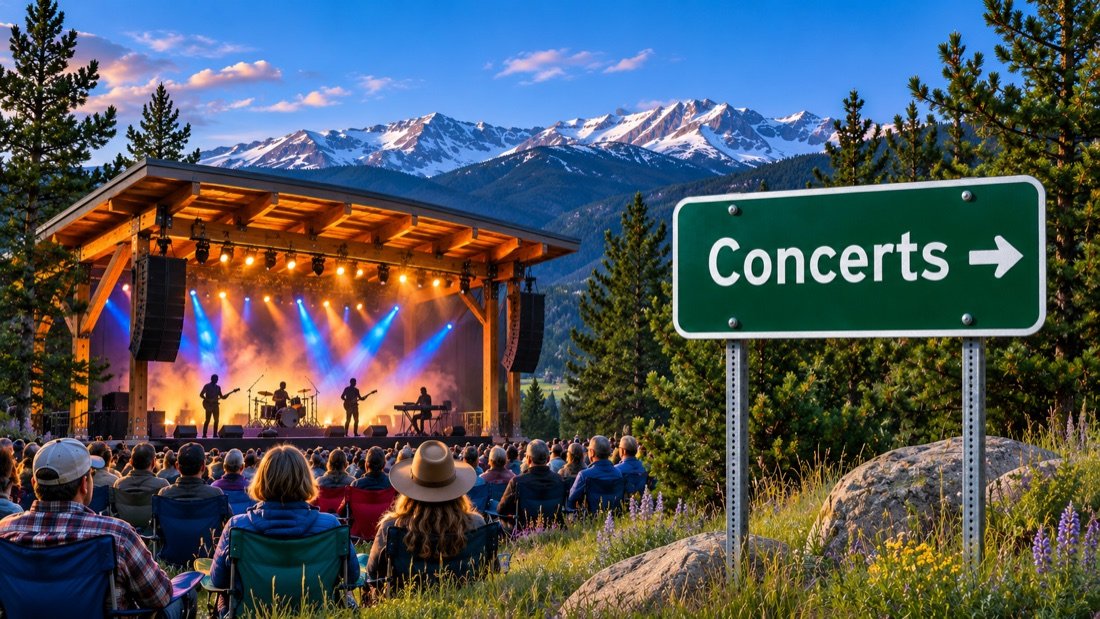 ColorFest weekend · dates pendingBands, Brews & Barrels
Honk! matinee
Honk! evening performance

Pagosa Turkey Trot 5K
Buckaroos Santa Rides
Holiday Market
Holiday Market
Local Appreciation Day
Local Appreciation Day
Local Appreciation Day
Local Appreciation Day
Festival of Trees viewing & voting
Festival of Trees dinner & auction
Local Appreciation Day
Local Appreciation Day
Local Appreciation Day
Local Appreciation Day
Hot Springs Fest
Christmas Carnival
Storybook Nutcracker
Nutcracker breakfast fundraiser
Storybook Nutcracker
Old Fashioned Christmas
View the events calendar
November 2026
Scroll across to see every day of the week.
Use the chevron to see more events for that day.
Planning around an annual event?
For summer trips, watch for the car show, rodeo, artisan market and county fair. In autumn, ColorFest brings balloon ascensions, food tastings and live music. Balloon flights depend on weather. Undated festivals stay off the day calendar until their organizers announce dates.
Local calendar and organizer listings checked November 21, 2026
Photo credits
- Event category artwork from the Open Road Colorado media collection.
Along the San Juan River
Hot springs & mineral pools
The Mother Spring supplies downtown’s geothermal bathing water. Each bathhouse has its own entrance, admission and pool layout. Choose the experience first, then check the operator’s daily pool list.

The Springs Resort
Riverfront soaking

Healing Waters Resort & Spa
Pool, soaking and downtown lodging

Overlook Hot Springs
Indoor baths and rooftop soaking

The Mother Spring
Geothermal source
Current pool availability at The Springs Resort
Photo credits
- Pagosa Hot Springs – hot springs soaking pools along the river sm · Netherzone · CC BY-SA 4.0
- Pagosa Hot Springs – The Mother Spring · Netherzone · CC BY-SA 4.0
- Pagosa Hot Springs rock pool on the banks of the San Juan River · Netherzone · CC BY-SA 4.0
- The Mother Spring – Pagosa Hot Springs, Colorado · Netherzone · CC BY-SA 4.0
Make room for an outdoor day
Hiking, biking & recreation
A quarter-mile paved loop at Chimney Rock and a full day along the Piedra River are very different outings. Start with the surface, distance and approach road, then check current access.
Hiking
For a short walk, compare Piedra Falls with the paved Mesa Village loop. For a longer trip, set a turnaround on the Piedra River Trail before leaving the trailhead.
Pagosa trail descriptionsBiking
Downtown paths normally connect river parks and street crossings. Check the town’s repair map before counting on a continuous paved ride.
Local access updatesMountain biking
Turkey Springs has linked forest trails. Around town, DUST2 posts community rides and trail workdays. Check the ride location and stay off saturated trails.
DUST2 ride calendarFly fishing
The San Juan and Piedra offer moving water, while Lake Capote has managed lake fishing west of town. Lake Capote uses Southern Ute permits and its own rules.
Lake Capote permits & hoursRafting & river trips
Spring runoff usually brings guided rafting. River flows, debris and damaged access points can change which sections outfitters can run. Confirm your launch with the operator before booking.
Current river and access informationSkiing & snowboarding
Wolf Creek is the downhill option east of Pagosa Springs. For a quieter day on Nordic skis, check the Pagosa Nordic Club’s latest grooming report and trail location.
Pagosa Nordic ClubDisc golf on Reservoir Hill
In season, play the wooded course above downtown. The climb and uneven ground make it a different outing from a level park course. Confirm the open approach after storms.
Course detailsGolf at Pagosa Springs Golf Club
In the warmer months, the public 27-hole club is an uptown option at 1 Pines Club Place. Check the tee sheet for which nines and times are available.
Tee times and course informationTheater & live performances
For an evening indoors, see what is on stage at the Pagosa Springs Center for the Arts. Thingamajig Theatre Company is its resident professional company. Community productions also take place at the high school.
Theater listingsCompare three Pagosa-area trails
Distances describe the published routes. Check forest road restrictions and seasonal gates before driving to a trailhead.
Mesa Village TrailEasy · ¼-mile loop · Paved
- Distance & time
- A short interpretive loop. Allow extra time for the drive from the entrance station to the mesa.
- Grade & surface
- Paved, wheelchair- and stroller-friendly loop. The Great House Pueblo Trail is a separate, rougher route.
- Trailhead
- From US 160 west of Pagosa Springs, turn south on CO 151. Check in at the monument entrance during its visitor season.
- Access & pets
- Service dogs are permitted. Pets cannot accompany visitors on interpretive trails.
Piedra Falls Trail No. 671Short · ½ mile each way · Natural surface
- Distance & time
- About one mile round trip from the Middle Fork trailhead. The unpaved approach takes considerably longer than the walk.
- Grade & surface
- A natural-surface path follows the water toward a narrow rock basin. Expect rocks and uneven footing.
- Trailhead
- Take Piedra Road north, then Middle Fork Road when open. The trailhead has no facilities.
- Access & pets
- COTREX lists leashed dogs. Check the ranger district for road access and keep clear of wet rocks near the falls.
Piedra River Trail No. 596Variable distance · Up to 12 miles one way
- Distance & time
- The full route connects two separate trailheads. For a short outing, walk out and return to the same car.
- Grade & surface
- From the Piedra Road end the trail descends off the canyon rim to the river. Washouts can interrupt the path.
- Trailhead
- The north access is beyond the Piedra River bridge on Piedra Road. The opposite trailhead is on First Fork Road.
- Access & pets
- A full traverse requires a vehicle shuttle. Ask the ranger district about bridges, damaged sections and pet restrictions before departure.
Take a look around
Explore downtown Pagosa Springs
Pagosa Street is the place to start for lunch, galleries and a look at the old commercial district. Hot Springs Boulevard connects the town center with the bathhouses. Ask locally about open crossings before following a riverfront route. Downtown dining and current hours


Photo credits
- PagosaSpringsCOSign · WhisperToMe · Public domain
- Pagosa Spring 1874 · Smithsonian Institution · Public domain
- San-Juan-River · Beck.Bowen · CC BY 4.0
Keep exploring
More fun things to do around Pagosa Springs
West on US 160, choose between archaeology and a day in Durango. East of town, the highway climbs above the valley before dropping into South Fork.
 West via US 160 and CO 151
Chimney Rock
Time a summer visit for a guided program. The monument’s interpreters explain how homes, kivas and skywatching fit together on this high mesa.
Plan the trip About 61 miles west
Durango
Walk historic Main Avenue, or reserve a Durango & Silverton Narrow Gauge Railroad excursion. Check which train and route your ticket covers.
Plan the trip East via US 160
Wolf Creek Pass & South Fork
Cross the Continental Divide and descend to the Rio Grande valley. Check conditions in both directions before committing to a same-day return.
Plan the tripPhoto credits
- Chimney Rock National Monument (16193238282) · Jeffrey Beall · CC BY-SA 2.0
- Downtown Durango, CO · Maplemoths · CC BY 4.0
- Snowing – Winter long Wolf Creek Pass in Colorado · Corey Leopold · CC BY 2.0
People of the upper San Juan
History of Pagosa Springs
Three places help tell the story: the inhabited mesa at Chimney Rock, the geothermal spring downtown and the old railroad junction south of town.

About 1,000 years agoAncestral Pueblo communities
At Chimney Rock, ancestral Pueblo people built homes, ceremonial spaces and a great house on a narrow ridge. The surviving walls make sense when you see their setting: the mesa overlooks the Piedra valley, and two rock pinnacles frame a distinctive view of the sky. The site remains culturally significant to descendant tribes. The lower trail introduces everyday village life before the upper trail climbs toward the great house.
Before and after 1878The spring and the army post
Ute and Jicarilla Apache people knew these waters long before a Colorado town appeared here. In 1878 the U.S. Army established a post near the hot spring that became Fort Lewis. Its later move west helps explain why the original fort and today’s Fort Lewis College are in different places. Pagosa’s townsite was surveyed in 1883, with streets and lots laid out alongside the river.
1900–1935A railroad branch into town
The first regional rail line passed well south of downtown. In 1900 a spur connected Pagosa Springs to the main line at Gato, also known as Pagosa Junction. Timber, ranching and the Hispano settlements along the San Juan shaped that economy. The branch operated until 1935. Stop at the seasonal history museum to put faces, tools and local photographs alongside the names on the map.
Town archaeological history · Chimney Rock visitor information · History museum
Photo credits
- “TEEPEE” BURNER INCINERATES WOODCHIPS AND SAWDUST FROM LUMBER MILL – NARA – 544954 · Boyd Norton / U.S. National Archives · Public domain
Arrive with a plan
Parking, accessibility & RV parks
Choose a lot for the part of town you want to visit. Downtown construction and flood repairs can change the shortest route between a parking space, a shop entrance and the river.
Downtown parking
Pagosa Street
Use the town parking map to find public spaces near the block you plan to visit.
Community center
451 Hot Springs Boulevard
The temporary visitor center is inside the Ross Aragon Community Center.
Oversized vehicles
RV & trailer parking
Ask the visitor center which signed public areas can accommodate your combined vehicle and trailer length.
Accessible parking
Step-free route planning
Choose a marked accessible space near the entrance you need. A riverside walk may involve a detour even when both endpoints are open.
Check the route from your space to the entrance
The visitor center can identify current closures. For an accessible pool, campsite or event seat, contact the venue directly about the features you need.
Flying in
Durango airport to Pagosa Springs
Durango–La Plata County Airport (DRO) is the closest airport with scheduled commercial flights. Stevens Field is in Pagosa Springs and serves general aviation.

Durango–La Plata County Airport
The airport is southeast of Durango. From the terminal, join US 160 east toward Bayfield and Pagosa Springs. You can reach Pagosa from this side without crossing Wolf Creek Pass.
Official airport informationDrive times
- DRO to downtown Pagosa Springs
- About 55–60 miles · 1 hr 10 min to 1 hr 30 min
Allow more time for winter driving or repair delays on US 160. The terminal and downtown Durango are different starting points.
Rental cars & pickups
Reserve a vehicle at DRO for the drive east. If booking a ride, give the transport company your lodging address in Pagosa Springs and confirm that it serves Archuleta County.
Shuttles & local travel
Confirm your pickup time, baggage space and fare for the entire trip before flying. A ride into downtown Durango leaves another 61 road miles to Pagosa Springs.
Nonstop flights
The airport lists year-round service to Denver, Dallas/Fort Worth and Phoenix, with seasonal service to Houston. Check the airline timetable for your travel day.
Flying into Albuquerque or Denver?
Albuquerque is about 212 road miles away by the usual northern New Mexico approach through Chama. Denver is about 270 miles by the shorter mountain route. Compare the full drive and any rental-car restrictions before booking.
Durango–La Plata County Airport · airlines, rental cars and ground transportation
Photo credits
- Illustrative aviation photograph by Niklas Jonasson · Unsplash License.
Local maps and trip advice
Pagosa Springs Visitor Center
During flood recovery, meet the visitor team at the Ross Aragon Community Center. This is the place to ask about an open river crossing, a snow-day itinerary, accessible parking or the drive to a trailhead.
Temporary visitor center
- Location
- 451 Hot Springs Boulevard, Pagosa Springs, CO 81147
- Published hours
- Daily, 10 a.m. to 4 p.m.
- Visitor information
- 970-585-1200
- Before you go
- Check the current location and hours
Visitor information checked November 21, 2026.
Plan the drive
Pagosa Springs map & driving directions
US 160 reaches Pagosa Springs from Durango to the west and Wolf Creek Pass to the east. US 84 enters from Chama, New Mexico. Choose your starting point below.
The map centers on town. Use the exact entrance for your bathhouse, lodging or trailhead when starting navigation.
Drive times & directions
| From | Miles | Drive time | Route |
|---|---|---|---|
| DenverUS 285 south to the San Luis Valley · US 160 west | ≈ 270 | 5–6 hr | Get directions |
| Colorado SpringsMountain approaches converge on US 160 west | ≈ 242 | 4½–5½ hr | Get directions |
| Grand JunctionUS 50 / US 550 south via Durango · US 160 east | ≈ 226 | 5–5½ hr | Get directions |
| DurangoUS 160 east via Bayfield | ≈ 61 | 1–1¼ hr | Get directions |
| Durango–La Plata County AirportAirport roads to US 160 east | ≈ 55–60 | 1¼–1½ hr | Get directions |
| AlbuquerqueNorth through New Mexico · US 84 via Chama | ≈ 212 | 3¾–4½ hr | Get directions |
Approximate driving estimates for the routes shown, before stops, storms or construction. Regional mileage · Live road conditions
Wolf Creek Pass travel update, November 21, 2026. CDOT announced the return of through travel at 7 a.m. after flood repairs. Check current conditions before departure and follow posted detours. CDOT reopening notice
A few things to know
Pagosa Springs travel questions
Plan the details that change a day here, from a walkable downtown stay to a winter drive over the pass.
Where should I stay for the hot springs?
Look downtown near Hot Springs Boulevard or Pagosa Street if soaking and walking to dinner are your priorities. The Springs Resort offers on-site lodging, and Healing Waters has rooms near its pools. Ask about the actual walking route while river crossings are being repaired.
Can I soak without staying overnight?
Yes. The Springs Resort sells day access, and Healing Waters publishes public pool hours. Day passes, maintenance closures, changing rooms and accessible pool entries differ by property.
Which airport should I book?
Choose Durango–La Plata County Airport (DRO) for the shortest scheduled-airline approach. Stevens Field is the town’s general aviation airport. Albuquerque is another option if its flight schedule works better for your trip.
Can I ski and soak on the same day?
Yes, when Wolf Creek Pass is open. Ski east of town, then return to a downtown bathhouse. Check the last lift, driving conditions and your bathhouse’s admission cutoff before setting a reservation.
Which outing works for a wheelchair user?
In the monument’s visitor season, the Mesa Village Trail at Chimney Rock is a paved quarter-mile loop. For a downtown visit, confirm the open curb cut, entrance and accessible restroom with the visitor center. Ask bathhouses which pools have working lifts or other suitable entries.
When can I visit the history museum and Chimney Rock?
The history museum lists Memorial Day through Labor Day. Chimney Rock usually has a longer May-to-October visitor season. Tour times, gates and upper-trail restrictions have separate schedules.
Can I camp overnight in a downtown parking lot?
Plan to sleep at a campground or permitted RV site. Ask about designated day parking separately. Lake Capote and the in-town RV parks have different seasons, hookups and reservation policies.
When is WinterFest, and when is ColorFest?
WinterFest is scheduled for January 15–17, 2027. ColorFest is the fall balloon and food weekend. Its 2027 dates were pending at the November 21, 2026 update.
What can I do if the river or forest roads are closed?
Plan a bathhouse visit, browse the Pagosa Street shops or check the local theater calendar. The temporary visitor center at 451 Hot Springs Boulevard can match your visit to open attractions that day.