Open Road Colorado
COLORADO, YOUR WAY
Somewhere good is waiting

Where do you want to go?

Find Your Open Road Find a trip
Your next good detour starts here

Find Your Open Road.

Pick a starting point, make a little time, and see what calls to you.

Curated starting ideas. Driving times are rough estimates each way, before stops or traffic. Check road and seasonal access conditions before heading out.

Vail, Colorado

Gore Creek Valley

Vail, Colorado

Follow Gore Creek from the shops of Vail Village to the gardens at Ford Park, or head to Lionshead for the Eagle Bahn Gondola. The free town bus connects both villages.

View my bucket list

Saved in this browser. View your list in the Visitor Center.
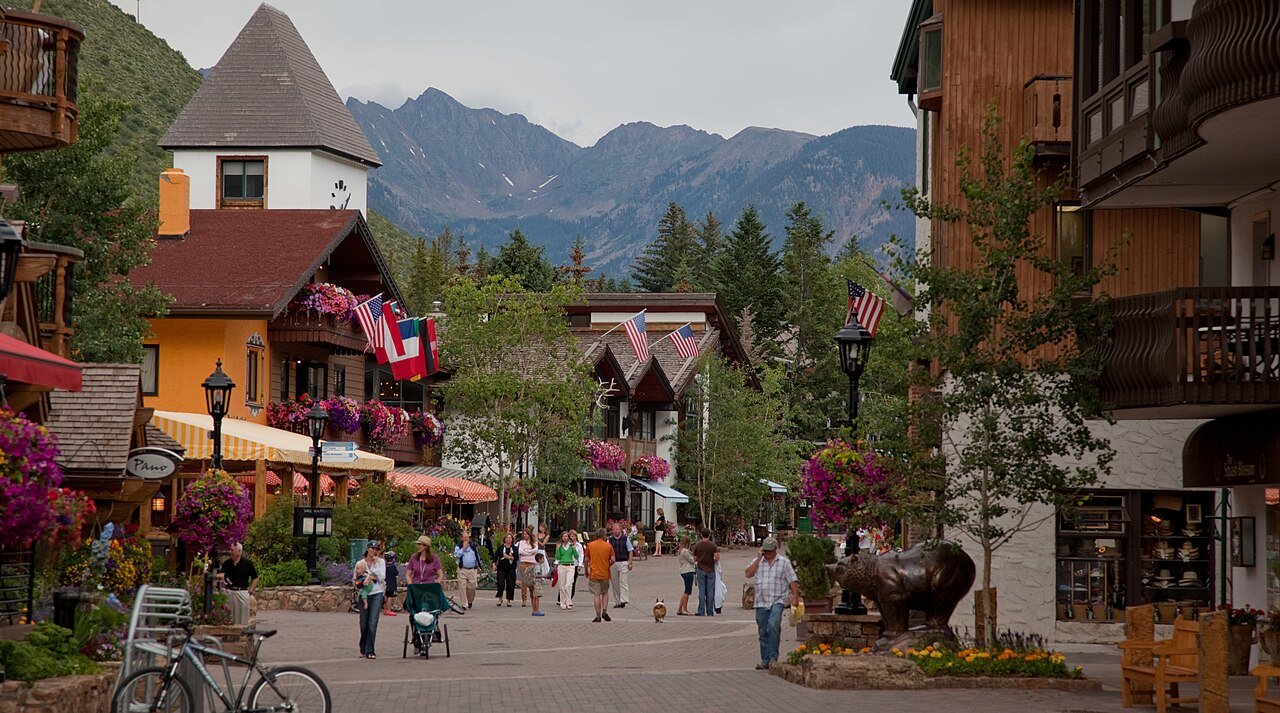
Gore Creek Drive in Vail Village with the Gore Range behind the buildings
VailGore Creek Drive in Vail Village with the Gore Range behind the buildings
Shopping streets of Vail Village
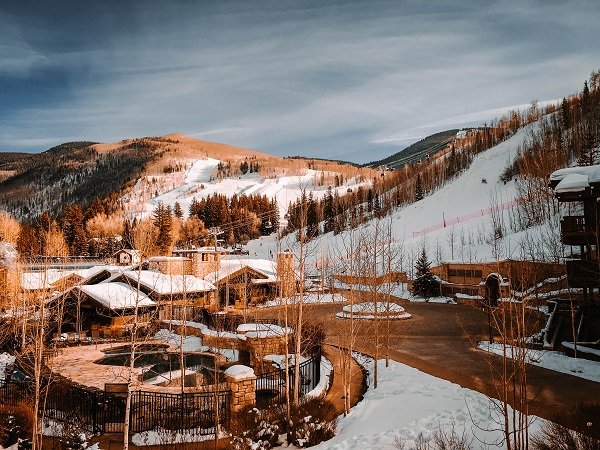
Vail Mountain above the village

Photo: Nick Csakany · CC BY-SA 4.0. Image resized for web display.

Village shopping and mountain photographs from the Open Road Colorado Vail collection.

Best for
Skiing, walkable villages, summer arts and Gore Range scenery
Suggested stay
Two or three nights, with a separate day for a longer trail or river trip
Main approach
I-70; use COtrip for mountain corridor conditions
Getting around
Free Town of Vail buses connect the local villages

Discover Vail

Vail through the seasons

Ski days and village evenings

Start with the mountain operating report, then plan a village stop around your day.
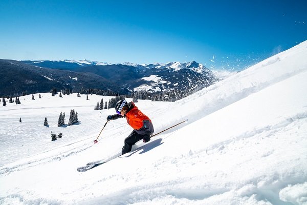
Skiing and snowboarding

Choose lifts and terrain around ability and current operations.

Explore details

Winter village walks

Explore Vail Village and Lionshead, allowing for snow and icy surfaces.

Explore details

Gardens in winter

Betty Ford Alpine Gardens offers a different winter outing; verify its current program and equipment needs.

Explore details

Choose your stops

Things to do in Vail

Browse the highlights, open a guide or save a stop for your trip.

Walk Gore Creek to Betty Ford Alpine Gardens

From Vail Village, follow Betty Ford Way along the creek toward Ford Park. At the gardens, trade the riverside path for the alpine plant collections and the bridge by the perennial pond. The return walk makes a good counterpoint to a day spent on the lifts.

For a shorter approach, start at the Ford Park parking area and bus stop. The gardens describe the tour paths as accessible and flag uneven surfaces along the way.

Garden map and visitor information

How Vail became a town

Long before the first chairlift carried a paying skier, this valley was part of the Ute homeland. The name on highway signs today came through a different route. Vail Pass took its name from highway engineer Charles Vail, and the mountain community later adopted the name of the pass.

In March 1957, Earl Eaton and Pete Seibert set out before dawn from the highway below the mountain. They followed an old logging road near what is now Golden Peak, then broke trail through deep snow. From the ridge they could see how a skier might move across the mountain. Seibert had trained with the 10th Mountain Division, and a run called Riva Ridge still connects the ski area with the division’s wartime history.

The ski mountain came first. Construction began in spring 1962, and the resort opened that December. Residents incorporated the Town of Vail in 1966. The dates mark two different beginnings for a place that visitors often think of simply as a ski resort.

The shift toward summer travel changed how people used the mountain. Lifts carried sightseers, mountain bikers gained trails, and concerts brought audiences to the valley long after ski season. A summer visit today follows that same geography, from the mountain above the village to the creek paths and performance spaces below.

Town of Vail history · Eaton and Seibert’s route

Walking and biking in Vail

Gore Valley Trail

The town lists 12 miles for the full route. Pick a shorter stretch for a village walk or use the paved path for a longer ride. Account for the return distance when choosing a turnaround.

Vail Pass by bike

The paved Vail Pass and Tenmile Canyon recreation trail meets the Gore Creek Campground area at its west end. This gives cyclists a different option from the nearby Eagles Nest Wilderness trails, which are open to foot and horse travel.

Explore Vail hiking and biking
Booth Lake via Booth Creek

Allow a full day for this advanced nine-mile round trip with about 3,000 feet of climbing. The trail climbs through aspens, passes the falls and finishes with a steep, rocky approach. The falls are an earlier turnaround. Take the East Vail bus and walk up Booth Falls Road. There is no trailhead or neighborhood parking. Keep dogs on a physical leash and leave bikes outside the wilderness.

Trail map and current access

Go a little deeper

Choose your kind of adventure

Map and Driving Directions to Vail

Use these city-to-city estimates to plan your drive. Mountain pass closures can change the route, mileage and travel time substantially. Check COtrip for open roads before departure.

Starting cityRoad milesEstimated driveRoute
Denver97 mi1h 46mDirections
Colorado Springs140 mi3h 4mDirections
Pueblo173 mi3h 37mDirections
Fort Collins148 mi3h 5mDirections
Boulder104 mi2h 4mDirections
Grand Junction147 mi2h 23mDirections
Breckenridge35 mi42 minDirections

From Denver follow I-70 west over Vail Pass. From Grand Junction follow I-70 east through Glenwood Canyon. From Breckenridge take CO 9 north to Frisco and join I-70 west. Allow about two hours from Denver International Airport in favorable conditions.

Make a weekend of it

Vail events

Choose a month or jump to the next announced event. Select an event date for its official program.

Event calendar

Select an event date to open its official program. Times are on the organizer’s program.

Confirmed date ranges only. Selected-performance seasons are listed below the calendar without daily event markers. Schedules can change; confirm with each organizer.

Also worth planning around

Dates checked November 14, 2026. Daily programs and admission are set by the organizers.

Camping and RV sites near Vail

Gore Creek Campground

Six miles east of Vail, this White River National Forest campground sits at 8,700 feet. Choose a back-in site for an RV or a walk-in site for a tent. Parking spurs reach a maximum of 35 feet, so check the length of the individual site before reserving.

Site 18 is designated as an accessible tent site. Each site has a bear-resistant food locker. Use the reservation listing for seasonal availability, vehicle allowances and current fire restrictions.

Compare sites and reserve at Gore Creek

Parking and accessibility in Vail

Park for the village you plan to visit

Use the Vail Village structure for Bridge Street and the walk toward Ford Park. The Lionshead structure puts you closer to the Eagle Bahn Gondola. Red Sandstone is another option between the two villages. Rates change by date and season.

Parking locations and current rates

Plan a shorter garden approach

If the creek walk from Vail Village would be too long, use the Ford Park entrance for Betty Ford Alpine Gardens. Parts of the garden paths are uneven. Check the garden map for the entrance closest to your destination.

Garden access and map

Where to eat, shop and stay

Choose your starting point

For a morning on the mountain, look at lodging around the Eagle Bahn in Lionshead. For an evening hopping between restaurants, browse the pedestrian streets of Vail Village. The free in-town shuttle connects the two, so dinner and your room can be in different villages.

Explore the village districts

On Bridge Street, the Red Lion makes a convenient village dinner stop. For a meal near the Lionshead lifts, look at Garfinkel’s. Stay near Bridge Street for the restaurants and shops around Vail Village, or near Lionshead Square for morning access to the Eagle Bahn. Confirm the walk from the parking structure before booking a room.

Find restaurants, shops and lodging on the village map

Vail itineraries

A few hours on foot

Park at Vail Village, stop at the Colorado Snowsports Museum, then follow Bridge Street to Gore Creek. Leave time for lunch before returning to the structure.

A summer day

Walk Betty Ford Way to the alpine gardens in the morning. Picnic at Ford Park, then ride the village bus to Lionshead. If the gondola is operating, check the last download before buying a ticket.

A winter weekend

Spend the first day on Vail Mountain, choosing a base near your rentals or lesson. On the second morning trade the lifts for groomed tracks at Vail Nordic Center, then finish with a village dinner.

Vail visitor questions

Where can I start a shorter walk to the gardens?

Start at Ford Park. For a longer approach from Vail Village, follow Betty Ford Way beside Gore Creek.

Can I bring a large RV to Gore Creek?

The longest campsite spurs are 35 feet. Compare the listed parking length for your specific site with your rig before booking.

More mountain towns from Vail

Breckenridge

Head east over Vail Pass and turn south at Frisco for Breckenridge. Pair a walk on Main Street with time along the Blue River.

Explore Breckenridge

Aspen

For a longer trip west, continue toward Glenwood Springs and follow the Roaring Fork Valley to Aspen. Save time downtown for the pedestrian malls and Wheeler Opera House.

Explore Aspen

Your Open Road Bucket List

Save a place. Plan the trip.

0 saved stops in this browser.

Open my bucket list
Sources, photo credits and map details

Planning information checked November 14, 2026. Follow the linked operators and land managers for changes.

Photo credits

The destination map pin represents the town area. It is not a trailhead, parking entrance or route instruction. Specific attraction points are recorded only when a source can be verified. Use the official access information before setting out. OpenStreetMap-derived attraction points, where used, are credited to OpenStreetMap contributors under the ODbL.

Local help

Vail Visitor Center

Vail Village and Lionshead welcome centers

Vail Village: 241 S. Frontage Road, Suite 8150. Lionshead: 395 E. Lionshead Circle.

Vail Village: 970-477-3522. Lionshead: 970-477-3523.

The Village desk is on level 4 and the Lionshead desk is on level 1. Both open daily from 9 a.m. to 5 p.m. Stop at the welcome center in the village where you park. The two centers are in different parking structures.

Visitor information

8 thoughts on “Vail, Colorado”

  1. Pingback: Wildlife & Fall Photography Around Vail

  2. Pingback: Skiing & Winter Recreation Around Vail

  3. Pingback: Colorado Snowsports Museum | Vail Visitor Guide

  4. Pingback: Fishing & Rafting Around Vail

  5. Pingback: Hiking & Biking Around Vail

  6. Pingback: Breckenridge, Colorado: Things to Do & Travel Guide

  7. Pingback: Steamboat Springs, Colorado: Things to Do & Travel Guide

  8. Pingback: Colorado Weather Forecasts by Destination

Leave a Comment

Scroll to Top