
Gore Creek Valley
Wildlife & Fall Photography Around Vail
Vail’s fall scenery is varied enough that you do not need one perfect viewpoint to have a worthwhile photography day. The village, Gore Creek, gardens and higher slopes offer different subjects. Start with current access and color information, then choose a small area to explore slowly. Wildlife is an occasional part of that landscape, never a promised attraction.
Saved in this browser. View your list in the Visitor Center.
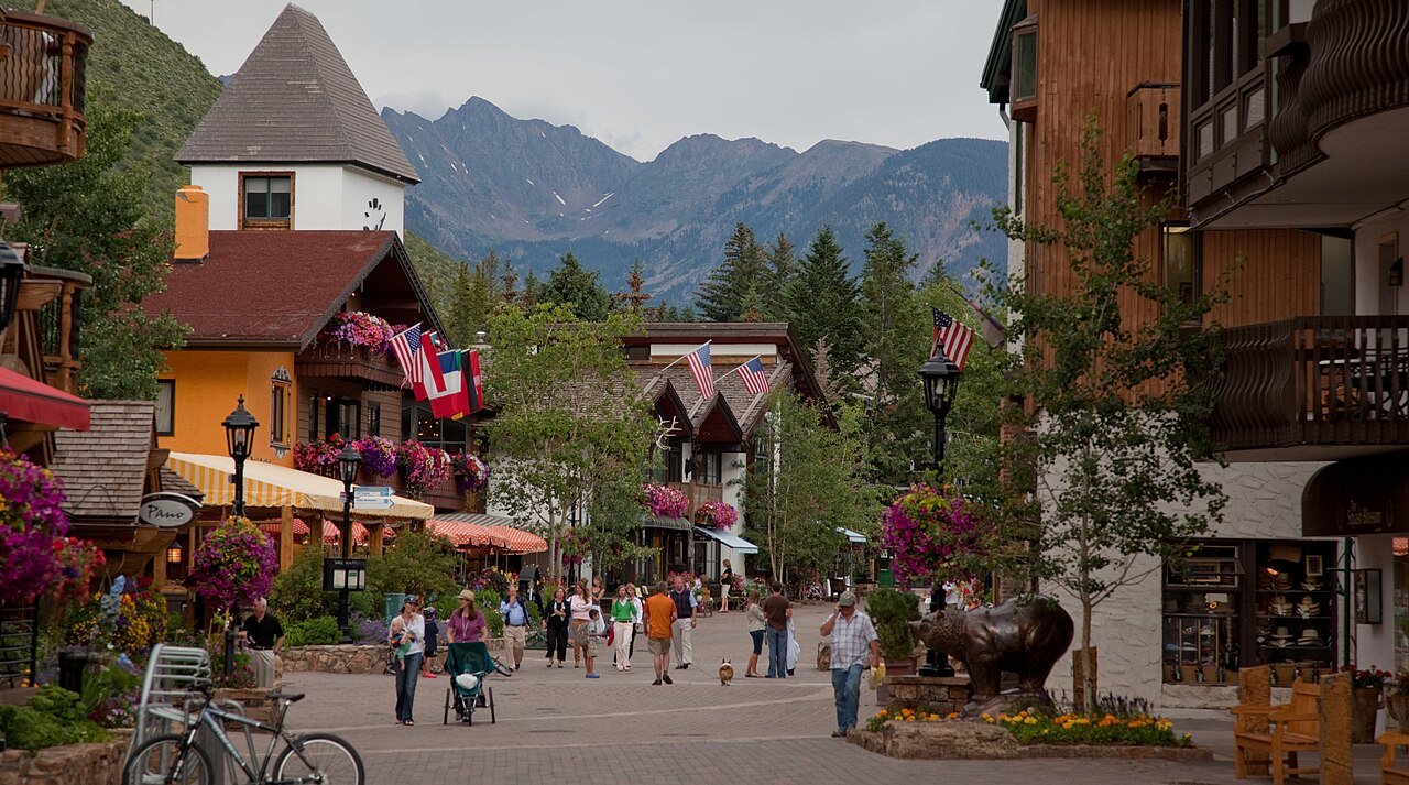
Photo: Nick Csakany · CC BY-SA 4.0. Image resized for web display.

Work with the creek and villages
Gore Creek gives a useful foreground for mountain and fall-color photographs, while village bridges and pedestrian routes make shorter outings possible. Look for a composition from an established path and keep your tripod or camera bag out of the travel lane. The changing light on water can be enough of a subject without a long drive.
This is also a sensible option when high-country weather is uncertain or someone in the group wants a shorter walk. Select an exact path segment, check its surface and choose a return point before the outing becomes tiring. The goal is time to observe, not a mileage target. Keep private banks and landscaped areas outside your route unless they are clearly open to visitors.
Official planning information · Additional official guidance
Use gardens for close detail
Betty Ford Alpine Gardens offers a different scale of subject: alpine plants, textures, seed heads and the relationship between carefully interpreted habitats. It can add variety to a set of broad mountain images. Use the visitor map and remain on the established paths rather than stepping into a bed for a closer angle.
Season changes what is visible. A garden visit after summer bloom is not a failed flower trip; it is a different photographic opportunity. Check program and visitor information, and respect any areas temporarily closed for work or conditions. If photographing other visitors, give them space and keep the scene about the place rather than interrupting their day to arrange your shot.
Official planning information · Additional official guidance
Plan mountain color without assuming lift access
A scenic gondola ride can provide a broader view of fall slopes when it is operating. Check the current schedule before making it the central part of the day, including the last return and any weather interruption. The calendar for summer lifts may end before the color or snow season does.
Regional locations such as Piney Lake involve their own access plan. A map’s short straight-line distance does not describe an unpaved approach, and a photograph does not prove current road conditions. Choose a lower alternative if the road or weather is unsuitable. Once at a viewpoint, spend time with smaller details and changing light rather than stopping in an unsafe roadside location for a hurried wide shot.
Official planning information · Additional official guidance · Additional official guidance
Keep wildlife observation low-pressure
Use binoculars or a longer lens and allow animals to move away freely. Do not approach, feed or call them to improve a photograph. Seasonal closures exist to protect habitat and should remain part of the route plan even when no animal is visible. A naturalist-led outing can be a useful way to learn what you are looking at without turning a sighting into a pursuit.
Fall light fades quickly behind mountain terrain, so build in a comfortable return rather than waiting until the last possible minute. Note the actual location and date of your photos so you can find a favorite view again. A few details about the approach and the light will help you choose where to return on a later visit.
Official planning information · Additional official guidance · Additional official guidance
Keep planning
More ways to explore
Skiing & winter recreation
Plan winter outings around Vail, with activity choices, seasonal access and practical resources.
Read the guideHiking & biking
Explore hiking and biking around Vail, with route choices, access details and official trail resources.
Read the guideRafting & fishing
Plan rafting and fishing near Vail, with river choices, seasonal access and current planning resources.
Read the guideYour Open Road Bucket List
Save a place. Plan the trip.
0 saved stops in this browser.
Sources, photo credits and map details
Planning information checked November 14, 2026. Follow the linked operators and land managers for changes.
- Betty Ford Alpine Gardens visit information
- Betty Ford Alpine Gardens collections
- CPW nature viewing
- Vail fall activities
- Vail fall routes and walks
- Vail lakes and waterfalls
- Vail Nature Discovery Center
- www.fs.usda.gov
- www.openstreetmap.org
- www.openstreetmap.org
- Town of Vail recreation paths
- www.wikidata.org
- www.wikidata.org
- 2025 Census Gazetteer Colorado places, internal representative points
Photo credits
- Photo: Nick Csakany · CC BY-SA 4.0. Image resized for web display.
The destination map pin represents the town area. It is not a trailhead, parking entrance or route instruction. Specific attraction points are recorded only when a source can be verified. Use the official access information before setting out. OpenStreetMap-derived attraction points, where used, are credited to OpenStreetMap contributors under the ODbL.