
Chaffee County · Upper Arkansas Valley
Buena Vista, Colorado
Stand on the footbridge at the end of East Main Street and you can watch paddlers work the Arkansas River with the Collegiate Peaks behind town. Head west for a soak at Cottonwood or Charlotte, or follow Chalk Creek to Mount Princeton. In summer, give Browns Canyon and the road over Cottonwood Pass a day of their own.
Saved in this browser.


Photo credits
- Mount Princeton from the Cottonwood Pass road · David Herrera · Photo source and credit
- Mount Princeton Hot Springs Resort in the Chalk Creek valley · Scott Peterson · Photo source and credit
- East Main Street in downtown Buena Vista · Greg Tally · Photo source and credit
- County
- Chaffee CountyUpper Arkansas Valley
- Town elevation
- About 8,000 feetBelow the Collegiate Peaks
- River access
- East Main StreetFootbridge at River Park
- Hot springs
- Two west of townMore near Nathrop and Salida
Choose your stops
Fun things to do in Buena Vista, Colorado
A walk from Main Street to the river works any time of year. Save a longer summer afternoon for the rapids or the Continental Divide, then choose a hot spring on your way back.
 All year
Soak in the hot springs
Compare open-air mineral pools, Chalk Creek soaking and indoor swimming in Salida.
Cottonwood and Charlotte have separate entrances west of town. Mount Princeton is south of Buena Vista in the Chalk Creek valley.
Colorado Historic Hot Springs Loop
Compare hot springs All year
Buena Vista River Park
Walk to the water at the east end of Main Street and watch paddlers in the whitewater park. Cross the footbridge for a view back toward the peaks.
Stay on the town side for a shorter river walk. The trails across the bridge climb into rockier terrain.
Explore the town parks Summer
Raft Browns Canyon
Downstream of town the Arkansas bends between granite walls in Browns Canyon National Monument. Outfitters run guided trips through this stretch.
Use the meeting point on your booking. Your outfitter can match the boat, trip length and rapids to your group and the current flow.
Arkansas Headwaters river access
Explore Browns Canyon Seasonal
Buena Vista Heritage Museum
The old Chaffee County courthouse at 506 East Main houses local history exhibits and a model railroad. Pair it with a walk through the historic business district.
Check opening days with Buena Vista Heritage, especially outside summer.
Historic Town Hall on East Main
Visit Buena Vista Heritage Summer & fall
Drive Cottonwood Pass
Follow County Road 306 west from town as cottonwoods give way to switchbacks and a view across the Continental Divide.
The upper pass closes seasonally. You can visit the lower-valley hot springs without driving over the summit.
Directions to Cottonwood Pass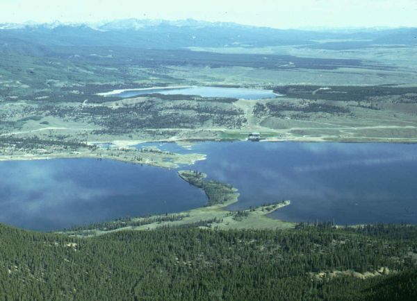 Summer & fall
Explore Twin Lakes
Head north on US 24, then west on CO 82 to the lakes and historic village. Pull over for views across the water toward the high peaks.
Twin Lakes is east of Independence Pass. A visit to the lakes does not require crossing the pass.
Directions to Twin LakesYour selections are saved in this browser.
Photo credits
- Mount Princeton Hot Springs Resort near Nathrop · Scott Peterson · Photo source and credit
- Life jacket loan station at the Buena Vista riverfront · Nolabob · Photo source and credit
- Browns Canyon National Monument · Bureau of Land Management · Photo source and credit
- Former Chaffee County courthouse and jail in Buena Vista · Jeffrey Beall · Photo source and credit
- Continental Divide sign at Cottonwood Pass · Zephyrnthesky · Photo source and credit
- Twin Lakes north of Buena Vista · Hadal · Photo source and credit
Add something to your trip
Upcoming events & festivals in Buena Vista
The holiday parade comes down East Main Street, and spring trail races head into the foothills east of the river. Open a date on the calendar for organizer details.
Buena Vista events to plan around
Confirmed dates from event organizers and the local chamber.
 Nov 26, 2026Buena Vista Turkey Trot & Family Fun Run
 Dec 5, 2026Hometown Holidays Parade of Lights & Tree Lighting
 May 1, 2027Collegiate Peaks Trail Run
Buena Vista Turkey Trot & Family Fun Run
Hometown Holidays Parade of Lights & Tree Lighting
View the events calendar
November 2026
Scroll across to see every day of the week.
Use the chevron to see more events for that day.
Annual festivals to watch
CKS Paddlefest brings the whitewater community to town around Memorial Day weekend. Gold Rush Days celebrates the valley’s mining history with pack burro racing, and 14er Fest brings trail users downtown in fall. Check the organizers for their next dates.
Buena Vista Chamber of Commerce
Photo credits
- Event category artwork by Open Road Colorado.
Soak in the upper Arkansas Valley
Hot springs near Buena Vista
For a short trip from Main Street, head west to Cottonwood or Charlotte. For creekside soaking, turn south toward Nathrop. Salida’s indoor pools make a good choice when someone in your group wants to swim laps.

Cottonwood Hot Springs Inn & Spa
About 5 miles west · 18999 County Road 306

Charlotte Hot Springs & Botanical Gardens
West of town · 19256 County Road 343

Mount Princeton Hot Springs Resort
Near Nathrop · 15870 County Road 162

Salida Hot Springs Aquatic Center
About 25 miles south · Salida
Colorado Historic Hot Springs Loop
Photo credits
- Soaking pools at Cottonwood Hot Springs Inn & Spa · Cottonwood Hot Springs Inn & Spa · Photo source and credit
- Mount Princeton above the upper Arkansas Valley · Jonathan Thorne · Photo source and credit
- Hot springs at Mount Princeton · Scott Peterson · Photo source and credit
- Salida Hot Springs Aquatic Center · Eric Ramsey · Photo source and credit
Make room for an outdoor day
Hiking, biking & recreation
East of the Arkansas, trails climb through piñon and granite with open views of the Sawatch Range. West of town, the landscape changes again as Cottonwood Creek climbs toward the Continental Divide.
Hiking
Cross the East Main footbridge and take the Barbara Whipple Trail uphill for a view across the valley. Stay beside the river for a shorter morning walk.
Visitor informationBiking
Ride between the riverfront and South Main before adding a climb. Check the town trail map to see where town paths meet singletrack.
Visitor informationMountain biking
Across the river, the Midland network follows portions of an old railroad grade. Approach trails and connecting singletrack add rock, exposure and climbing.
Visitor informationFishing
The Arkansas Headwaters Recreation Area maps river access. Choose a marked public access point and check Colorado Parks and Wildlife regulations for the reach you plan to fish.
Visitor informationRafting & kayaking
Compare a guided Browns Canyon trip with a gentler family float. For experienced paddlers, the town whitewater park offers a separate option without an outfitter shuttle.
Visitor informationDownhill skiing
Monarch Mountain is about 40 road miles away via US 285 and US 50. Ski Cooper is about 43 miles north via Leadville and US 24. Breckenridge is about 61 miles via Fairplay and CO 9 over Hoosier Pass.
Monarch Mountain · Ski Cooper · Breckenridge guideCompare Buena Vista trails
Choose the riverbank for a gentle outing, the bluff for a view back toward town, or the old Midland grade for a longer ride.
River Park riverside pathsEasy · Choose your turnaround
- Distance & time
- Start with a 20–40 minute stroll and turn back at the footbridge or South Main.
- Climbing & surface
- Valley-floor paths. Surfaces change between paved town streets and gravel by the water.
- Trailhead
- Begin at River Park, 800 East Main Street.
- Access & dogs
- For a step-free route, ask BV Recreation which approaches are currently open.
Barbara Whipple TrailUphill · East bank
- Distance & time
- Plan about an hour for a walk up to a viewpoint and back, depending on your turnaround.
- Climbing & surface
- Rocky footing and switchbacks above the footbridge. The westward view takes in town and the Collegiate Peaks.
- Trailhead
- Park on the town side and cross the river on foot.
- Access & dogs
- Expect a narrower, less even trail beyond the bridge. Share the route with cyclists.
Midland trailsVariable · Old rail grade
- Distance & time
- Choose an out-and-back or use the trail map to connect a longer loop.
- Climbing & surface
- The railroad bench is more gradual than many of the connectors. Rocky sections interrupt the grade.
- Trailhead
- Use a mapped trailhead and include the approach when estimating mileage.
- Access & dogs
- Carry the trail map and check seasonal trail conditions.
Take a look around
Explore downtown Buena Vista
East Main runs from US 24 toward the Arkansas River. On foot, you can stop at the old bank building, see the railroad exhibits and finish at South Main for dinner beside the water.


Photo credits
- Historic Town Hall on East Main Street · Elisa.rolle · Photo source and credit
- The historic South Park railroad depot in Buena Vista · David Wilson · Photo source and credit
- Historic railcar in Buena Vista · Tyler Lahti · Photo source and credit
Keep exploring
More fun things to do around Buena Vista
Pick a direction for an afternoon trip. Cottonwood Pass heads west into the alpine zone, the lakes sit north on US 24, and Salida lies downriver.
 West of town
Cottonwood Pass
In summer, stop at the divide for views toward the Taylor Park side. Check the county road status before committing to the crossing.
Explore Cottonwood Pass North on US 24
Twin Lakes village
Bring a picnic for lake views or walk through the historic village. The east-side approach stays separate from the seasonal road to Aspen.
Explore Twin Lakes village South on US 285
Salida
Combine the indoor hot springs pool with a walk around Salida’s Arkansas River waterfront and downtown galleries.
Explore SalidaPhoto credits
- Alpine meadows south of Cottonwood Pass · Roy Luck · Photo source and credit
- Twin Peaks above Twin Lakes · Mark Byzewski · Photo source and credit
- Historic downtown Salida · Jeffrey Beall · Photo source and credit
From the railroad to the river
History of Buena Vista
A courthouse, a depot and a bank still standing on East Main tell the story of a town built where the mountain routes met the Arkansas River.

The valleyBefore the townsite
The Arkansas Valley was part of the homeland and travel routes of Ute people long before a grid of streets appeared here. The river gave travelers a corridor between South Park, the Sawatch Range and the lower Arkansas Valley.
Late 1800sThe railroad arrives
Railroads carried passengers, supplies and mining traffic into the upper valley. The old South Park depot and surviving railcars help explain why the town developed around a corridor between the mountains and the water. Across the river, portions of the Midland grade survive as trails.
1880sBanks and county government
The former county courthouse on East Main now holds the Buena Vista Heritage Museum. Farther west, the corner building now used as Town Hall was built as the Bank of Buena Vista in 1883. Look for the locally made brick and carved stone around its windows.
TodayA town facing the river
The whitewater park and South Main bring visitors back to the Arkansas for a different reason. From the East Main footbridge, you can see both the modern paddling features and the bluffs that once carried the railroad above town.
Buena Vista Heritage · Historic Town Hall
Photo credits
- Buena Vista in the nineteenth century · Unknown photographer, public domain · Photo source and credit
Arrive with a plan
Parking & RV parks near Buena Vista
Use downtown parking for East Main shops and museums, River Park for the footbridge and the operator’s own lot for a hot springs visit or raft departure.
East Main Street
Historic business district
Read block signs before leaving the car for a long hike.
River Park
800 East Main Street
Start here for the pedestrian bridge, whitewater viewing and trails.
Soaking pool parking
Use the operator’s address
Cottonwood is on CR 306, Charlotte on CR 343 and Mount Princeton on CR 162.
Ruby Mountain
Arkansas Headwaters Recreation Area
Check the state park’s access map and current entry requirements before driving to a launch.
Accessible parking, trails & pool entry
The street-level downtown route and the bluff trails have very different surfaces. Ask town recreation about the current step-free river access. For a soak, confirm the changing facilities, pool lift or transfer steps at the specific pool. Creekside pools have uneven rocks and a different approach from a developed bathhouse.
Flying in
Flying to Buena Vista
Aspen/Pitkin County Airport (ASE) is about 67 road miles from Buena Vista when Independence Pass is open. The pass closes for winter. Gunnison–Crested Butte Regional Airport (GUC) is about 85 miles away via Monarch Pass. Colorado Springs and Denver offer additional flights from the Front Range. Central Colorado Regional Airport (AEJ) serves general aviation in town.

Colorado Springs Airport
From Colorado Springs, follow US 24 west through Woodland Park and South Park. After Trout Creek Pass, turn north at Johnson Village for downtown Buena Vista.
Colorado Springs Airport informationDriving from Colorado Springs
- Colorado Springs to Buena Vista
- About two hours in good conditions
Allow extra time to collect a rental car and reach US 24 from the airport.
Flying into Aspen or Gunnison
From Aspen, take CO 82 over Independence Pass to US 24 when the pass is open. From Gunnison, take US 50 over Monarch Pass, then US 285 north at Poncha Springs. Check mountain road conditions before leaving either airport.
Driving from Denver
US 285 goes southwest through Fairplay and South Park. Allow additional time from Denver International Airport on the far side of the metro area.
Flying privately
Central Colorado Regional Airport (AEJ) is in Buena Vista. Arrange ground transportation with the airport before landing.
Flying into Denver instead?
Compare Denver flight times with the longer drive via US 285. Check mountain road conditions before leaving the airport.
Denver International AirportPhoto credits
- Colorado Springs Airport terminal · NWL757 · Photo source and credit
Local maps and trip advice
Buena Vista Visitor Center
The Buena Vista Chamber can help with local maps, festival dates and overnight options. For the latest river-trail conditions, contact town recreation on East Main Street.
Buena Vista Chamber of Commerce
- Location
- 111 East Main Street, Buena Vista, CO 81211
- Published hours
- Call the Chamber for current walk-in hours.
- Visitor information
- 719-395-6612
- Parks and trails
- Town recreation office
Visitor information from the Buena Vista Chamber of Commerce and Colorado Tourism Office.
Plan the drive
Buena Vista map & driving directions
Downtown sits on US 24, where East Main leads straight to the river. From the Front Range, US 24 and US 285 meet east of Trout Creek Pass.
The map marks the Chamber on East Main. Use the individual hot spring’s address for the last few miles of your drive.
Drive times & directions
| From | Miles | Drive time | Route |
|---|---|---|---|
| DenverUS 285 southwest via Fairplay | ≈ 122 | 2¼–2¾ hr | Get directions |
| Colorado SpringsUS 24 west via Woodland Park | ≈ 94 | 1¾–2¼ hr | Get directions |
| Grand JunctionI-70 to Minturn, then US 24 via Leadville | ≈ 200 | 3¾–4½ hr | Get directions |
Approximate city-center road distances and planning times. Weather and road work can extend the drive.
Cottonwood Pass and Independence Pass have seasonal closures. Check your full route before following a summer shortcut. COtrip road conditions
A few things to know
Buena Vista travel questions
Plan a soak, pick a river outing and decide how far you want to drive for a ski day.
Which hot springs are closest to Buena Vista?
Cottonwood and Charlotte are both a short drive west of downtown. Cottonwood is on County Road 306. For Charlotte, turn onto County Road 343. They are separate properties with separate admissions.
Can I visit Mount Princeton without booking a room?
Yes. Public day passes are sold on site. Some pools and spa facilities have separate access rules, and Chalk Creek conditions can affect creekside soaking.
Where can we swim indoors?
Salida Hot Springs Aquatic Center is about 25 miles south. Check its schedule for open swim or lap lanes.
How far away are the ski resorts?
From Buena Vista, plan on about 40 road miles to Monarch Mountain, 43 to Ski Cooper and 61 to Breckenridge. These are one-way estimates. Allow extra time on snowy passes.
Can I cross Cottonwood Pass in winter?
The high pass closes seasonally. The hot springs west of town sit below the summit closure. Check the county road status or contact your hot spring when storms move through.
Where should I stay for rafting and hot springs?
Stay near East Main or South Main to walk to restaurants and the river. Choose the Cottonwood Creek or Chalk Creek valley if you want lodging by the pools. For rafting, use the outfitter’s check-in address when comparing lodgings.