
Larimer County · Northern Front Range
Fort Collins, Colorado
Start in Old Town Square, follow the Cache la Poudre River by bike, or head west to paddle Horsetooth Reservoir. Colorado State University sits just south of downtown, close enough to pair a campus visit with a walk along College Avenue.
Saved in this browser.


Photo credits
- Fort Collins Historic District · Wusel007 · Source and license
- Horsetooth Reservoir · Lvaughn7 · Source and license
- Cache la Poudre River in Fort Collins · Decumanus · Source and license
- County
- Larimer CountyNorthern Colorado
- City elevation
- About 5,000 feetAt the foot of the Front Range
- River
- Cache la PoudrePaved trail through town
- Denver approach
- Interstate 25Exit 269 for Old Town
Choose your stops
Fun things to do in Fort Collins, Colorado
Start with a few stops that fit together. Old Town, the museum and the river work well on foot or by bike. Allow a separate half day for the foothills.
 All year
Old Town Square
Start on the brick plaza, then follow Linden Street past the storefronts to Jefferson Street.
Use a downtown garage if you want to browse without moving your car between stops.
Plan your visit All year
Fort Collins Museum of Discovery
Try hands-on music and science exhibits near the Poudre River and the north edge of downtown.
Check theater showtimes separately from museum admission. Leave time for the river path outside.
Plan your visit All year
Colorado State University
Walk the elm-lined Oval, take a campus tour or plan a Rams game at Canvas Stadium.
Visitor parking and game-day parking operate differently. Check your tour confirmation or game ticket before choosing a lot.
Plan your visit All year
New Belgium Brewing
Cross the river from Old Town for the brewery’s Fort Collins taproom on Linden Street.
Check tour reservations independently of taproom hours. Odell Brewing is another stop on the east side of downtown.
Plan your visit Summer
Fort Collins Trolley
Ride a restored Birney streetcar along Mountain Avenue between City Park and downtown.
Check the seasonal operating calendar before taking a one-way ride. City Park makes a good starting point for families.
Plan your visit Spring through fall
Horsetooth Rock
Hike above the reservoir toward the rock formation visible from town. The foothill climb is considerably steeper than the city paths.
Use the Horsetooth Mountain trailhead and check parking status and trail closures before driving west.
Plan your visit All year
Poudre River Trail
Follow the river through town on a paved multiuse path. The section near Lee Martinez Park makes an easy addition to a downtown visit.
Choose an out-and-back distance. High water and construction can close underpasses, so check the city trail map.
Plan your visitYour selections are saved in this browser.
Photo credits
- Old Town Square · LiquidPerson · Source and license
- Fort Collins Museum of Discovery · Zerdnog · Source and license
- Colorado State University in Fort Collins · Open Road Colorado media
- New Belgium Brewing in Fort Collins · M. Doxtad · Source and license
- Fort Collins trolley at City Park · Steve Morgan · Source and license
- Horsetooth Rock · Lvaughn7 · Source and license
- Cache la Poudre River in Fort Collins · Decumanus · Source and license
Add something to your trip
Upcoming events & festivals in Fort Collins
Find live music in Old Town, reserve an evening at the Gardens on Spring Creek or plan a Poudre Canyon race weekend. Calendar dates use Fort Collins local time.
Fort Collins events to plan around
Open an organizer’s listing for tickets, venues and arrival details.
 Dec 11–23 & 26–27, 2026Garden of Lights
 Apr 30–May 1, 2027FoCoMX
 May 2, 2027Colorado Marathon
 Jun 17–20, 2027FoCo Fondo
 Oct 9–10, 2027FoCo Fall FestDates tentative
Fort Collins Thanksgiving Day Run

Holiday Artisan Market
View the events calendar
November 2026
Scroll across to see every day of the week.
Use the chevron to see more events for that day.
More annual Fort Collins events
Look for the summer FoCo Food Truck Rally, Tour de Fat, Taste of Fort Collins and fall’s costumed Tour de Corgi. Check the organizer’s schedule before booking travel.
Visit Fort Collins event calendar
Photo credits
- Event artwork by Open Road Colorado.
West of town
Explore Horsetooth Reservoir
The long, narrow reservoir sits between hogback ridges just west of town. Pick your access point before you leave. A shoreline picnic, a boat launch and a summit hike start in different places.

Inlet Bay
Camping and marina access

South Bay
Swimming and paddling

Reservoir overlooks
A foothills drive

Lory State Park
Trails on the west side
Larimer County reservoir access, permits and closures
Photo credits
- Inlet Bay at Horsetooth Reservoir · Lvaughn7 · Source and license
- The foothills around Horsetooth Reservoir · Ken Gallager · Source and license
- Hogback ridges across Horsetooth Reservoir · Lvaughn7 · Source and license
- Arthur’s Rock at Lory State Park · Lvaughn7 · Source and license
Make room for an outdoor day
Hiking, biking & recreation
Ride along the river in town, walk the Spring Creek corridor or climb into the foothills west of the reservoir. Start with the surface and elevation gain that suit your group.
Hiking
For a foothill climb, head to Horsetooth Mountain Open Space. The summit approach is rocky and exposed.
Visitor informationBiking
Connect the Spring Creek and Poudre trails for a longer ride on pavement. Use the city map to plan your return.
Visitor informationMountain biking
Lory State Park offers valley routes and more demanding climbs. Check trail designations and closures before riding.
Visitor informationFishing
Try shore fishing at Horsetooth or choose a public river access. Check Colorado fishing rules and the posted boundaries.
Visitor informationRafting & river trips
Local outfitters run seasonal trips on the Cache la Poudre northwest of town. The launch depends on the trip and river level.
Visitor informationPaddling
Put in at a designated reservoir access and plan the return before heading across open water.
Visitor informationCompare Fort Collins trails
Choose a short paved outing or allow half a day for a foothills hike.
Poudre Trail at Lee Martinez ParkEasy · Paved · Choose your turnaround
- Distance & time
- Try a 2-mile out-and-back by turning around after the first mile.
- Climbing & surface
- Mostly level pavement with shared bicycle traffic.
- Start & parking
- Start near Lee Martinez Park on North Sherwood Street.
- Access & dogs
- Check underpass closures, especially after high water.
Spring Creek TrailEasy · Paved · City park access
- Distance & time
- Start with a 1-mile outing or keep riding east toward the Poudre.
- Climbing & surface
- Paved multiuse trail with road crossings and underpasses.
- Start & parking
- Start at Spring Canyon Park on West Horsetooth Road.
- Access & dogs
- The park has accessible recreation facilities. Check the route for current detours.
Horsetooth RockStrenuous · Rocky summit approach
- Distance & time
- Allow roughly half a day for the approximately 5-mile round trip.
- Climbing & surface
- A sustained foothill climb with uneven footing near the rock.
- Start & reservations
- Use the county’s Horsetooth Mountain trailhead. An entrance permit is required.
- Access & dogs
- Check current closures and the county trail map before starting.
Take a look around
Explore downtown Fort Collins
Follow College Avenue past the Northern Hotel, turn onto Mountain Avenue, then walk toward the historic depot and the river.


Photo credits
- Northern Hotel on College Avenue · Xnatedawgx · Source and license
- Old Town off Mountain Avenue · Renoman58 · Source and license
- Historic Union Pacific depot · LiquidPerson · Source and license
Keep exploring
More fun things to do around Fort Collins
Head south for outdoor sculpture, west for foothill trails or follow the Big Thompson Canyon toward Estes Park.
 South · Loveland
Benson Sculpture Garden
Walk among outdoor sculptures set along landscaped paths and ponds.
Explore Benson Sculpture Garden West · Bellvue
Lory State Park
Explore valley trails near the reservoir or choose a steeper hike to Arthur’s Rock.
Explore Lory State Park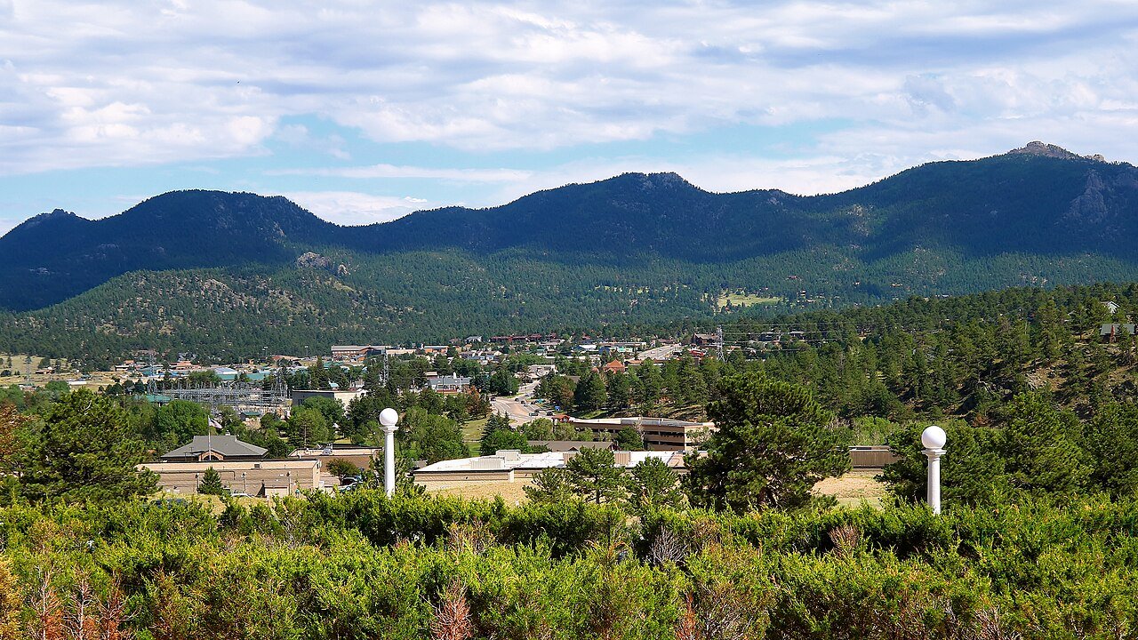 Southwest · Estes Park
Estes Park
Take US 34 through Big Thompson Canyon for a mountain-town day trip near Rocky Mountain National Park.
Explore Estes ParkPhoto credits
- Benson Sculpture Garden in Loveland · Ijon · Source and license
- Lory State Park looking toward the ridges · Lvaughn7 · Source and license
- Estes Park, Colorado · Open Road Colorado media
Along the Cache la Poudre
History of Fort Collins
The river explains where the town began. The old street grid and the agricultural college explain much of what visitors see today.

Before the fortA river corridor
Arapaho and Cheyenne people traveled and lived across the northern Front Range long before a military post stood here. The Cache la Poudre linked the plains and the mountains. The river that visitors follow west into the canyon was already an important corridor.
1864Camp Collins moves downstream
A flood damaged the Army camp near present-day Laporte. Soldiers moved the post downstream to higher ground near what is now Old Town. The new site gave the later civilian settlement its name. The post itself lasted only a few years.
1870sTwo street grids meet
Early streets followed the river and the military settlement. A later town plan laid out streets on north–south and east–west lines. At Linden, Mountain and College, those plans meet at an angle. You can see the change in direction on a short walk through the historic district.
1879An agricultural college opens
Colorado Agricultural College began holding classes south of town in 1879. It grew into Colorado State University. Walking from Old Town to the Oval takes you from the early commercial district to the landscaped center of the campus that helped shape the city.
Local history · City historic context
Photo credits
- Fort Collins on a 1906 USGS map · U.S. Geological Survey · Source and license
Arrive with a plan
Parking & RV parks near Fort Collins
Use a downtown garage for Old Town, check CSU visitor parking before a campus tour and reserve overnight sites through the campground.
Downtown garages
Old Town, Civic Center and Firehouse Alley
Choose the garage closest to your first stop. Old Town and Firehouse Alley are convenient for the square.
CSU visitor parking
Colorado State University
Select a visitor lot or a signed short-term space for your campus visit.
Horsetooth day parking
Larimer County recreation areas
Choose the lot for your planned activity. The marina, South Bay and the mountain trailhead are distinct destinations.
Oversized vehicles
Day stops and overnight stays
Check clearance before entering a downtown structure. Contact the parking office about surface options for your vehicle.
Accessible parking & getting around
Check the city map for designated accessible parking near your downtown stop. Spring Canyon Park offers accessible play features and paved paths. For transit access, confirm the stop, boarding point and any detours with Transfort.
Flying in
Denver International Airport to Fort Collins
Denver International Airport is the main commercial arrival point. Choose between a reserved shuttle to Fort Collins and a rental car for a foothills or canyon itinerary.

Denver International Airport
For Old Town or CSU, compare shuttle stops before booking. The Harmony Transfer Center is east of town, while the CSU Transit Center is on campus.
Denver airport informationDriving from DEN
Allow roughly 75–100 minutes in ordinary traffic. E-470 is a toll road. Check your rental agreement and compare the route via I-70 and I-270 before leaving.
Airport shuttle
Landline lists stops at CSU, Harmony Transfer Center and Northern Colorado Regional Airport. Select the stop that matches your hotel or pickup plan.
Rental cars
Allow time for the rental-car transfer at DEN. A car makes it easier to combine Horsetooth, Bellvue and the Poudre Canyon.
Getting around town
Old Town and the campus can work well without a car. Check the MAX route and Transfort schedule for trips along the Mason corridor.
What about Northern Colorado Regional Airport?
Northern Colorado Regional Airport (FNL) is between Loveland and Fort Collins. Check your booking for the actual departure airport. A shuttle departing FNL can connect to a flight at DEN.
Northern Colorado Regional AirportFort Collins airport shuttle stops
Photo credits
- Jeppesen Terminal at Denver International Airport · Open Road Colorado media
Local maps and trip advice
Fort Collins Visitor Center
Stop in Old Town Square for walking maps, local events and help choosing an afternoon in town or a route into the foothills.
Visit Fort Collins Welcome Center
- Location
- 7 Old Town Square, Suite 100, Fort Collins, CO 80524
- Published hours
- Monday–Saturday, 8 a.m.–5 p.m. Sunday, 11 a.m.–4 p.m. Check holiday hours.
- Visitor information
- 970-232-3840
Visitor information from Visit Fort Collins.
Plan the drive
Fort Collins map & driving directions
From I-25, take Mulberry Street west for Old Town, Prospect Road for CSU or Harmony Road for the south side of town.
The map centers on Old Town Square. Use your garage, trailhead or campground as the final destination.
Drive times & directions
| From | Miles | Drive time | Route |
|---|---|---|---|
| DenverI-25 north | ≈ 65 | 1–1½ hr | Get directions |
| Colorado SpringsI-25 north through Denver | ≈ 133 | 2¼–3 hr | Get directions |
| Grand JunctionI-70 east, then north toward Fort Collins | ≈ 303 | 5–6 hr | Get directions |
Approximate road distances and planning times. Traffic and mountain conditions can extend the drive.
Check I-25 traffic on the Front Range and I-70 conditions when approaching from western Colorado. COtrip road conditions
A few things to know
Fort Collins travel questions
Practical details for Old Town, CSU, the reservoir and the drive from Denver.
What can I do in Fort Collins in one day?
Start at Old Town Square, walk Linden Street and visit the Museum of Discovery. Finish with a short Poudre River walk or drive west to a reservoir overlook before sunset.
Where should I stay for a first visit?
Choose Old Town for walkable restaurants, music and galleries. Stay near CSU for campus visits and game days, or reserve a Horsetooth campground for early access to the water.
Can I visit without a car?
An airport shuttle to CSU puts you close to campus and downtown. Transfort serves the city. Arrange a separate ride for Horsetooth Reservoir or a Poudre Canyon trip.
Do I need a pass for Horsetooth Reservoir?
Larimer County requires an entrance permit. Camping is a separate reservation. Lory State Park on the west side has a separate state park entrance system.
Where can I take a wheelchair or stroller?
Spring Canyon Park has accessible play facilities and connections to paved paths. Check the city trail map for closures. For Old Town, use the city parking map to choose an accessible space close to your destination.
When should I visit?
Spring brings FoCoMX and the Colorado Marathon. Summer is better for paddling and trolley rides. In December, combine an Old Town evening with a timed Garden of Lights visit.