
Front Range mountains
Central City, Colorado
Explore Central City’s historic streets, opera, museums and nearby mountain recreation with practical access notes and seasonal trip ideas.
Saved in this browser. View your list in the Visitor Center.
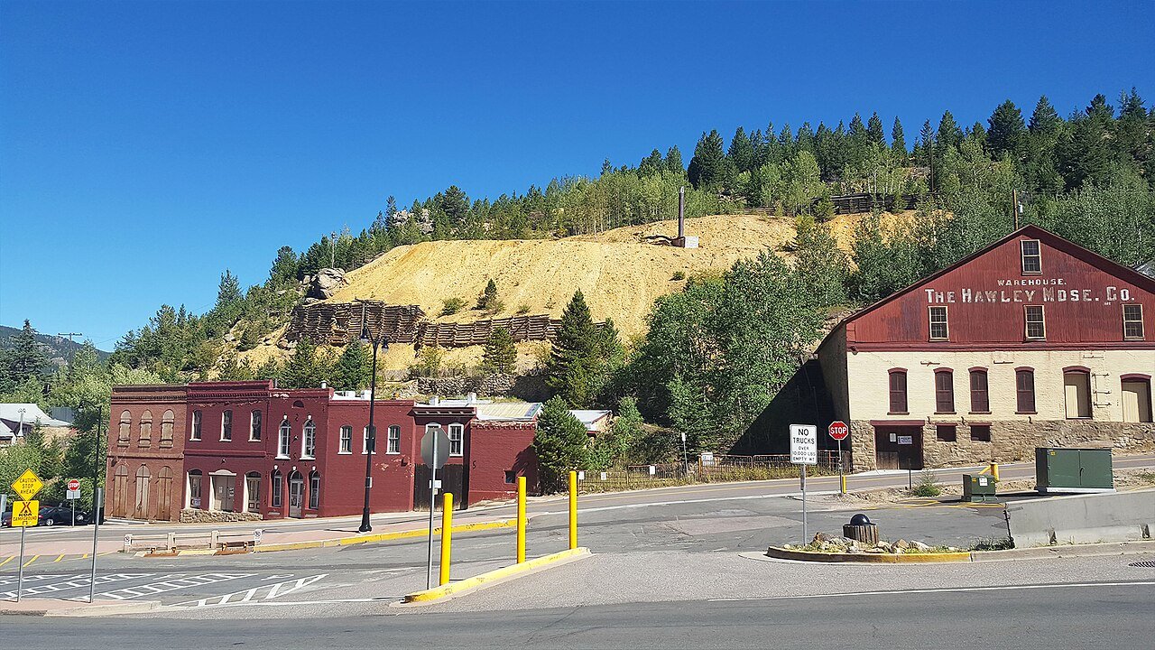
Photo: D&RG Railfan · CC BY 3.0. Image resized for web display.

- Region
- Gilpin County / Front Range mountains
- Known for
- Gold Rush history, opera and Victorian streets
- Common road approach
- I-70 exit 243 and Central City Parkway
- Best pace
- A history day plus one nearby outdoor outing
Start here
Get to know Central City
Central City's story is still visible in its streets. The Opera House, Teller House and smaller historic buildings give this mountain town a character that is easy to miss if you only know it for casinos. Begin with the walking tour or a historical-society visit, then give yourself time to look up at the façades and follow the changes in the hillside streets.
The familiar nickname, the Richest Square Mile on Earth, belongs to the town's Gold Rush identity. It is not a current wealth ranking. For a fuller visit, combine that history with one outdoor outing in the surrounding mountains. Nearby Black Hawk's Maryland Mountain trails and Golden Gate Canyon State Park offer very different experiences from a downtown walk. Clear Creek rafting and an Eldora ski day are regional excursions rather than activities on Central City's Main Street, so keep each in its own part of the plan.
Read the town through its buildings
The preserved 1878 Opera House and 1872 Teller House are concrete starting points for the town's history. The Thomas House offers a smaller domestic story, with interiors associated with the family that lived there around the turn of the twentieth century. Use those places to understand how people lived and worked, with room for both the town's public institutions and its domestic history.
Official planning information · Additional official guidance
Choose your stops
Things to do in Central City
Browse the highlights, open a guide or save a stop for your trip.
Self-guided historic walk
Start with the official walking-tour route so the buildings connect into a story.
More about this stop
Start with the official walking-tour route so the buildings connect into a story. Street grades matter here: choose a shorter loop if the group is not comfortable with hills, and leave room for an indoor stop rather than treating the whole town as level pavement.
 Open Road ColoradoExplore Central City
Central City Opera
A performance can become the anchor for a summer visit.
More about this stop
A performance can become the anchor for a summer visit. The 2027 festival is announced for June 26 through August 1, but that is a season range, not a promise of a performance every day. Select the actual production and date before arranging the rest of the trip.
Open Road ColoradoExplore Central CityTeller House and historic interiors
Gilpin Historical Society tours include the Teller House, Opera House and other properties.
More about this stop
Gilpin Historical Society tours include the Teller House, Opera House and other properties. The tour office is at Washington Hall. Some tours involve stairs and substantial walking, and opera activity can affect building availability.
Open Road ColoradoExplore Central CityGilpin History Museum
The museum is a useful counterweight to the dramatic mining-town nickname, with objects and local stories that add detail to a street walk.
More about this stop
The museum is a useful counterweight to the dramatic mining-town nickname, with objects and local stories that add detail to a street walk. Its seasonal schedule differs from some of the guided properties. Confirm opening or an appointment rather than assuming every building follows the same hours.
Open Road ColoradoExplore Central CityMaryland Mountain in neighboring Black Hawk
Choose a designated hiking or mountain-bike route from the Hidden Treasure Trailhead.
More about this stop
Choose a designated hiking or mountain-bike route from the Hidden Treasure Trailhead. This is a separate open-space outing, with trail grades and bike-specific routes to consider. Do not assume every line on a mountain-bike map is a casual walking loop.
Open Road ColoradoExplore Central CityGolden Gate Canyon State Park
The park offers forest trails, picnic areas and pond fishing.
More about this stop
The park offers forest trails, picnic areas and pond fishing. It is a useful regional addition when you want an outdoor day beyond the historic center. Check current entry routes: seasonal road closures can make the shortest-looking connection unavailable.
6 places to explore
Location photographs: Branded illustrations identify stops without a location photo.
Four seasons, different plans
When to visit
Spring in Central City
Keep history and galleries as the dependable core while checking thawing trail conditions separately. Shaded roads and trails can remain winterlike. A walking tour plus one confirmed museum visit is a better fit for an uncertain weather day than a long trail connection.
Summer in Central City
Plan around the opera or a scheduled town event, then add a morning walk or park outing. Festival times and historic-property tours need separate checks. Book the performance that matters to you first, rather than expecting to fit it around an already packed outdoor day.
Fall in Central City
Historic streets, cemetery landscapes and nearby forest trails suit a quieter photography outing. Follow posted access and treat cemeteries as places of remembrance. Mountain color and weather vary, so build the route around safe access instead of a promised peak-color weekend.
Winter in Central City
A winter visit can center on architecture, history and an indoor event. For Nordic or downhill recreation, travel to an appropriate managed area and verify its conditions. Golden Gate Canyon's winter road pattern can differ from the route a navigation app first suggests.
Go a little deeper
Choose your kind of adventure
Skiing & winter recreation
Plan winter outings around Central City, with activity choices, seasonal access and practical resources.
Read the guideHiking & biking
Explore hiking and biking around Central City, with route choices, access details and official trail resources.
Read the guideRafting & fishing
Plan rafting and fishing near Central City, with river choices, seasonal access and current planning resources.
Read the guideWildlife & fall photography
Find wildlife and landscape photography ideas around Central City, with seasonal planning and responsible viewing advice.
Read the guidePlan the drive
Getting to Central City
Choose your starting point, then open the current route and road conditions.
From Denver
Check live directions
Use your departure time and exact starting point for the current route and drive time.
Weather, closures and traffic can change the drive. Town map pins are not parking entrances.
From Colorado Springs
Check live directions
Use your departure time and exact starting point for the current route and drive time.
Weather, closures and traffic can change the drive. Town map pins are not parking entrances.
From Pueblo
Check live directions
Use your departure time and exact starting point for the current route and drive time.
Weather, closures and traffic can change the drive. Town map pins are not parking entrances.
From Fort Collins
Check live directions
Use your departure time and exact starting point for the current route and drive time.
Weather, closures and traffic can change the drive. Town map pins are not parking entrances.
From Grand Junction
Check live directions
Use your departure time and exact starting point for the current route and drive time.
Weather, closures and traffic can change the drive. Town map pins are not parking entrances.
Local transportation and accessibility
The visitor bureau directs drivers from I-70 to exit 243 and the Central City Parkway. Keep that road approach separate from trailhead directions in nearby Black Hawk or Golden Gate Canyon. Use COtrip before departure and live directions for your actual starting point. Check the current travel estimate for the planned departure, particularly during I-70 construction, weekend traffic or winter weather.
Historic buildings need individual checks
Gilpin Historical Society specifically notes that tours can include considerable walking and stairs. Ask about the exact building and route before booking. For a regional outdoor option, Golden Gate Canyon documents an accessible fishing pier at Kriley Pond. Those are separate access questions: a suitable outdoor pier does not establish access throughout Central City's steep streets and historic interiors.
Official planning information · Additional official guidance
View town areaMake a weekend of it
Central City events
Choose a month or jump to the next announced event. Select an event date for its official program.
Event calendar
Select an event date to open its official program. Times are on the organizer’s program.
Confirmed date ranges only. Selected-performance seasons are listed below the calendar without daily event markers. Schedules can change; confirm with each organizer.
Also worth planning around
- Madam Lou Bunch Day Next dates on the organizer’s website
- Stills in the Hills Next dates on the organizer’s website
Dates checked November 14, 2026. Daily programs and admission are set by the organizers.
Build a longer trip
Keep exploring Colorado
These are separate destinations. Check driving routes and allow time between them.
Your Open Road Bucket List
Save a place. Plan the trip.
0 saved stops in this browser.
Sources, photo credits and map details
Planning information checked November 14, 2026. Follow the linked operators and land managers for changes.
- Central City Opera 2027 season
- CPW: Golden Gate Canyon activities
- Black Hawk: Maryland Mountain open space
- Eldora Mountain Resort
- Gilpin Historical Society hours and locations
- Gilpin Historical Society: Thomas House
- Gilpin Historical Society tours
- Central City visitor information
- Central City events
- Central City self-guided walking tour
- www.wikidata.org
- www.wikidata.org
- www.wikidata.org
- 2025 Census Gazetteer: Colorado places
Photo credits
- Photo: D&RG Railfan · CC BY 3.0. Image resized for web display.
The destination map pin represents the town area. It is not a trailhead, parking entrance or route instruction. Specific attraction points are recorded only when a source can be verified. Use the official access information before setting out. OpenStreetMap-derived attraction points, where used, are credited to OpenStreetMap contributors under the ODbL.