
Front Range mountains
Hiking & Biking Around Central City
A Central City outdoor day can begin with historic streets or move into nearby forest and mountain-bike terrain. Choose the activity before choosing the route. A short distance on a map can hide steep grades, one-way bike trails or a seasonal closure.
Saved in this browser. View your list in the Visitor Center.
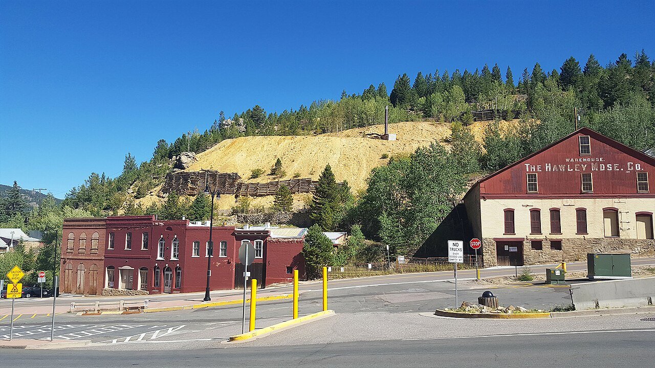
Photo: D&RG Railfan · CC BY 3.0. Image resized for web display.

Use the town walk as a different kind of outing
The official self-guided walk connects the historic buildings more meaningfully than wandering between isolated photo stops. It is still a mountain-town walk, with hills and changes in footing. Keep the route short enough to stop at a museum or gallery if you want to understand the history in more depth. This is a good first-day choice when the group wants to be outside without immediately committing to a long trail or a ride above town.
Official planning information · Additional official guidance
Head to Maryland Mountain for a mapped trail day
Maryland Mountain Quartz Valley Open Space is in neighboring Black Hawk, with access from Hidden Treasure Trailhead. The city identifies walking, hiking, running and mountain biking among its uses. Read the current route map carefully because a trail network designed for several activities is not a promise that every route is shared in every direction. Pick the route that matches the least experienced person in the group and be ready to change the plan if the surface is wet or icy.
Compare Golden Gate Canyon’s routes
Golden Gate Canyon State Park brings a forest-and-meadow setting to the regional itinerary. Choose a route by its permitted uses, surface and climbing rather than selecting the longest loop available. The park also provides picnic and pond options if part of the group wants a shorter day. Road access changes seasonally, so confirm the trailhead approach before departure. A useful outing leaves enough energy for the return instead of reaching the farthest point just as weather or daylight begins to deteriorate.
Do not assume a continuous Clear Creek connection
If you plan to combine the area with a ride in the Clear Creek corridor, check the county's current trail notices. Construction associated with the I-70 corridor has affected some connections. A route shown in an older article may no longer provide a continuous passage. Keep a route map available offline, choose a clear turnaround and avoid improvised detours into traffic. For first-time visitors, one well-understood local loop is usually a better introduction than an ambitious cross-area ride with uncertain links.
Keep planning
More ways to explore
Skiing & winter recreation
Plan winter outings around Central City, with activity choices, seasonal access and practical resources.
Read the guideRafting & fishing
Plan rafting and fishing near Central City, with river choices, seasonal access and current planning resources.
Read the guideWildlife & fall photography
Find wildlife and landscape photography ideas around Central City, with seasonal planning and responsible viewing advice.
Read the guideYour Open Road Bucket List
Save a place. Plan the trip.
0 saved stops in this browser.
Sources, photo credits and map details
Planning information checked November 14, 2026. Follow the linked operators and land managers for changes.
- Clear Creek County current trail conditions
- CPW: Golden Gate Canyon activities
- Black Hawk: Maryland Mountain open space
- Central City arts and culture
- Central City self-guided walking tour
- www.wikidata.org
- www.wikidata.org
- www.wikidata.org
- 2025 Census Gazetteer: Colorado places
Photo credits
- Photo: D&RG Railfan · CC BY 3.0. Image resized for web display.
The destination map pin represents the town area. It is not a trailhead, parking entrance or route instruction. Specific attraction points are recorded only when a source can be verified. Use the official access information before setting out. OpenStreetMap-derived attraction points, where used, are credited to OpenStreetMap contributors under the ODbL.