
Front Range mountains
Winter Recreation Around Central City
Central City is a useful winter choice if you want historic streets and an indoor visit alongside a separate snow outing. Begin with the town, then decide whether the surrounding roads and recreation areas support the larger day you have in mind.
Saved in this browser. View your list in the Visitor Center.
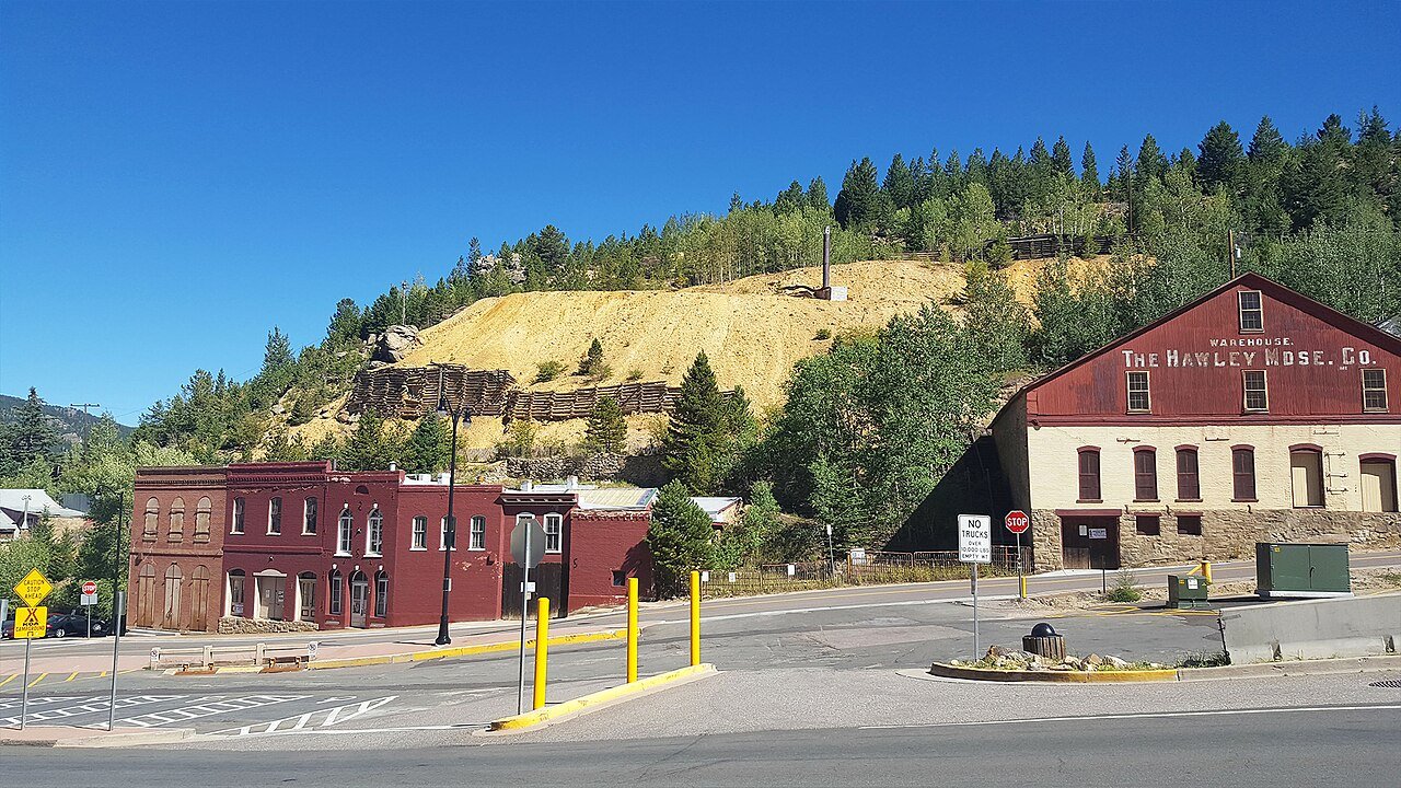
Photo: D&RG Railfan · CC BY 3.0. Image resized for web display.

Make the historic center the dependable part
A self-guided street walk can be shortened easily if the weather turns. Historic-building tours and museum visits require more specific planning: Gilpin Historical Society uses different seasonal schedules for different properties, and some tours involve substantial walking and stairs. Confirm the building you want to see rather than assuming the whole historic district operates as one attraction. Footwear that works on a snowy street matters even if most of the planned day will be indoors.
Official planning information · Additional official guidance · Additional official guidance
Read our Teller House in Central City guide for a closer look at the visit, current planning considerations and accessibility.
Read our Gilpin History Museum guide for a closer look at the visit, current planning considerations and accessibility.
Check Golden Gate Canyon’s winter approach
Golden Gate Canyon State Park provides a regional forest outing, but winter access can differ from the summer route. Mountain Base Road closes for winter, so use the park’s current access information before choosing a route. Use the current access map for your chosen trailhead rather than following a navigation shortcut. Start with a manageable route and an explicit turnaround point. A car park within reach of the city does not make the surrounding terrain or weather urban.
Use Eldora as a separate ski or Nordic day
Eldora offers lift-served skiing and a Nordic center near Nederland, which makes it a regional excursion from Central City. It should not be described as skiing in the historic town itself. Check the resort's operating calendar, snow report, lessons and transport before building the trip around it. Ignite Adaptive Sports provides instruction and equipment arrangements at Eldora; contact the program early if someone needs adapted support rather than relying on a last-minute walk-in request.
Official planning information · Additional official guidance
Leave space for the drive
Use COtrip for the approach and return, and consider whether you are combining too many mountain-road segments in one day. A visit can still be worthwhile if it stays with history and a short walk. Keep the ski day, a park snow outing and a performance as distinct choices, then select what fits conditions. When comparing itineraries, count time spent parking, changing footwear and reaching the activity as well as the nominal driving time. Fewer transitions usually make a winter day easier.
Official planning information · Additional official guidance
Keep planning
More ways to explore
Hiking & biking
Explore hiking and biking around Central City, with route choices, access details and official trail resources.
Read the guideRafting & fishing
Plan rafting and fishing near Central City, with river choices, seasonal access and current planning resources.
Read the guideWildlife & fall photography
Find wildlife and landscape photography ideas around Central City, with seasonal planning and responsible viewing advice.
Read the guideYour Open Road Bucket List
Save a place. Plan the trip.
0 saved stops in this browser.
Sources, photo credits and map details
Planning information checked November 14, 2026. Follow the linked operators and land managers for changes.
- CPW: Golden Gate Canyon activities
- Ignite Adaptive Sports at Eldora
- CDOT COtrip
- Eldora Mountain Resort
- Gilpin Historical Society hours and locations
- Gilpin Historical Society tours
- Central City recreation
- Central City self-guided walking tour
- www.wikidata.org
- www.wikidata.org
- www.wikidata.org
- 2025 Census Gazetteer: Colorado places
Photo credits
- Photo: D&RG Railfan · CC BY 3.0. Image resized for web display.
The destination map pin represents the town area. It is not a trailhead, parking entrance or route instruction. Specific attraction points are recorded only when a source can be verified. Use the official access information before setting out. OpenStreetMap-derived attraction points, where used, are credited to OpenStreetMap contributors under the ODbL.