
Denver metro
Wildlife & Fall Photography Around Denver
Denver's photographic range is wider than a skyline against mountains. River corridors, mature park trees and shortgrass prairie offer different subjects within the metropolitan region. Choose one setting and spend time observing instead of moving between a long list of viewpoints.
Saved in this browser. View your list in the Visitor Center.
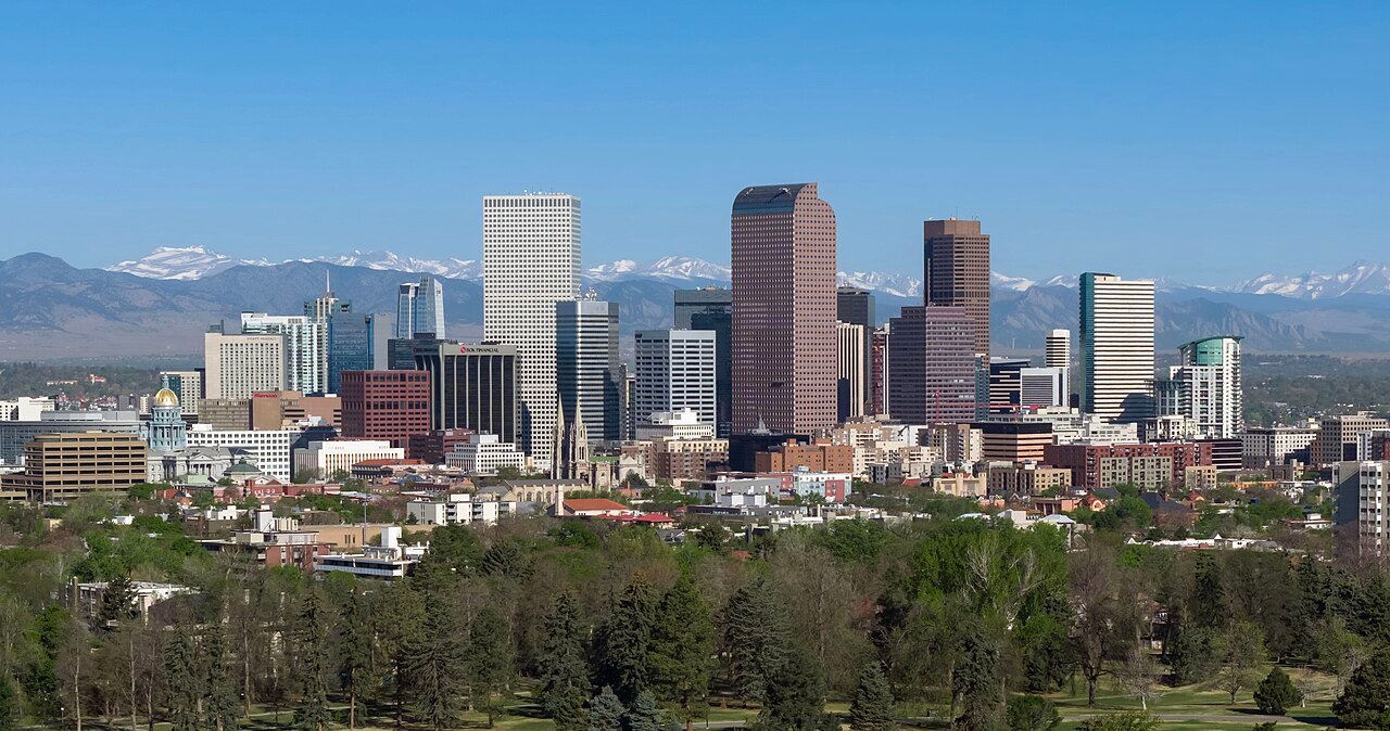
Photo: Quintin Soloviev · CC BY 4.0. Image resized for web display.

Visit the refuge with wildlife as the priority
Rocky Mountain Arsenal National Wildlife Refuge is the clearest choice for a dedicated wildlife outing near Denver. Choose the Wildlife Drive or a permitted walking route, and follow the instructions for bison areas. Stay in the vehicle when viewing the herd; a longer lens is the answer to distance, not an open door. The refuge is actively managed habitat, so closures and prescribed work can change access. Check the current notice before deciding which part of the property to visit.
Slow down around wetlands
On permitted refuge paths, the edges between water, reeds and grass are worth observing patiently. Lake Mary has a short loop with boardwalk and pier areas, while other routes offer a longer walk. Do not bring a pet, and do not leave the trail to reduce the distance to an animal. A wide scene showing the habitat can be more interesting than a tight portrait. Carry binoculars if you want to identify birds without continually lifting a camera.
Use city parks for color and composition
City Park can combine lake, trees, buildings and a distant mountain backdrop in the same outing. Washington Park and Cheesman Park offer other tree-lined city settings. Autumn color is a changing condition, not a booking guarantee; respond to what is there rather than looking for a specific shade from an old photograph. Try a close detail after making the broad view, and keep paths, lawns and the people using them part of the practical plan for where you place equipment.
Official planning information · Additional official guidance
Build an urban story as well as a landscape
Union Station and the route toward the river can make a useful architecture-and-public-space walk. Work from public areas and give people room to move through the scene. A morning built around a few connected blocks is easier to enjoy than repeated drives between distant photo points. If you add a foothills sunset, treat the drive back as part of the plan and check conditions before committing. The city remains a worthwhile subject when mountain visibility is poor.
Official planning information · Additional official guidance
Keep planning
More ways to explore
Skiing & winter recreation
Plan winter outings around Denver, with activity choices, seasonal access and practical resources.
Read the guideHiking & biking
Explore hiking and biking around Denver, with route choices, access details and official trail resources.
Read the guideRafting & fishing
Plan rafting and fishing near Denver, with river choices, seasonal access and current planning resources.
Read the guideYour Open Road Bucket List
Save a place. Plan the trip.
0 saved stops in this browser.
Sources, photo credits and map details
Planning information checked November 14, 2026. Follow the linked operators and land managers for changes.
- Visit Denver: Airport Rail
- Visit Denver: Winter Outdoor Activities
- Visit Denver: Outdoor Activities
- Visit Denver: Hiking
- USFWS: Rocky Mountain Arsenal National Wildlife Refuge
- USFWS: Arsenal hiking and trail access
- www.wikidata.org
- www.wikidata.org
- www.wikidata.org
- www.wikidata.org
- www.wikidata.org
- www.wikidata.org
- www.wikidata.org
- www.wikidata.org
- www.wikidata.org
- 2025 Census Gazetteer: Colorado places
Photo credits
- Photo: Quintin Soloviev · CC BY 4.0. Image resized for web display.
The destination map pin represents the town area. It is not a trailhead, parking entrance or route instruction. Specific attraction points are recorded only when a source can be verified. Use the official access information before setting out. OpenStreetMap-derived attraction points, where used, are credited to OpenStreetMap contributors under the ODbL.