
Southwest Colorado · San Juan Mountains
Telluride Wildlife and Fall Photography
Telluride offers more than one way to make a photograph. You can work close to town, follow river habitat, look across the valley from higher ground or plan a longer scenic-road outing. Choose the access and walking effort first, then the light and composition. A good photo day leaves time to wait, observe and change plans; it does not need a dozen locations or a guaranteed wildlife sighting.
Saved in this browser. View your list in the Visitor Center.
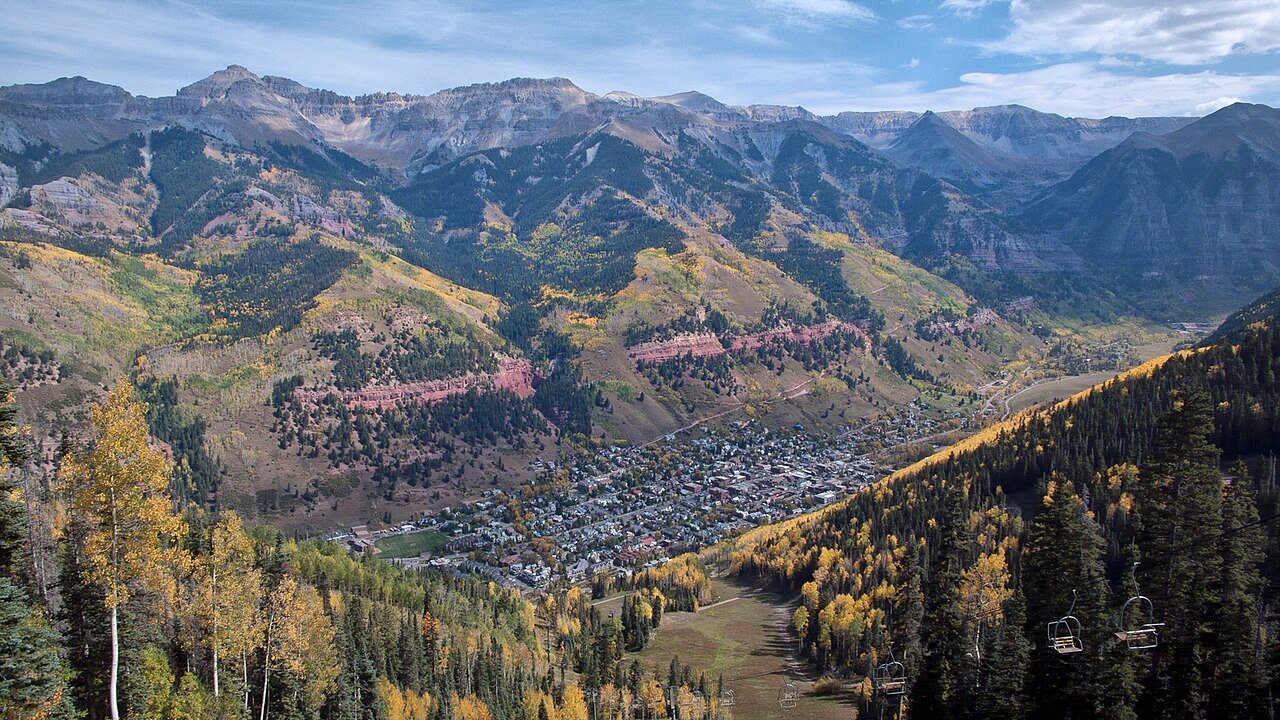
Photo: John Fowler · CC BY 2.0. Image resized for web display.

Build fall plans around a window
Late September into early October is a general fall-color planning period, with the timing changing from year to year. Use current foliage reports as the trip approaches. An image from a previous season cannot tell you what the same hillside will look like on your booked date.
Give yourself several subjects instead of one make-or-break scene. If the leaves are past their best, concentrate on the shape of the valley, town details, moving water or the relationship between forest and mountains. Keep a shorter outing available for poor weather. Flexibility is more useful than trying to force a fixed list of photographs through changing conditions.
Work close to town first
Start with public routes near the San Miguel River and the streets of Telluride. This keeps the first session easy to shorten and gives you time to decide what you want from the larger landscape. Avoid blocking paths or treating doorways, yards and private property as extensions of a public viewpoint.
If you want a higher view and are prepared for the climb, Jud Wiebe is a steep option above town. Choose it as a hike with camera equipment, not as a roadside photo stop. Check conditions, carry only what you need and leave enough time for the walk back. A tripod and several lenses change the effort even when the trail distance stays the same.
Official planning information · Additional official guidance
Treat the Valley Floor as habitat
The protected Valley Floor west of town combines open space, wetland and river habitat. Stay on designated routes and respect the restrictions that protect it. Dogs are not allowed west of the Boomerang Trailhead, so choose another outing if the day includes a pet.
For wildlife, bring patience and use binoculars or a longer lens instead of closing the distance. Colorado Parks and Wildlife advises backing away when an animal changes its behavior because of your presence. Do not feed, chase or crowd animals to improve a frame. If the scene requires disturbing the subject, the photograph can wait. Quiet observation is a worthwhile outing even when the camera stays in the bag.
Official planning information · Additional official guidance
Choose scenic drives for the vehicle you have
Trout Lake offers a regional lake setting roughly 15 miles from downtown. Keep parking and access separate from the shot you have in mind; use established public access and leave room for people who are fishing or visiting the water. A single location with time to explore can be more productive than a rushed circuit.
Last Dollar Road is a different commitment. The tourism board calls for a high-clearance four-wheel-drive vehicle on this unpaved route. Check road conditions before setting out and do not use it as an ordinary paved shortcut. If the vehicle or conditions do not fit, change the location. A dramatic road photograph is not a reason to improvise beyond your equipment or experience.
Official planning information · Additional official guidance
Add a river-habitat stop thoughtfully
San Miguel Canyon Preserve is a regional option for watching river habitat. It is open from dawn to dusk, with no established trail network. Plan for the conditions of an undeveloped preserve rather than expecting a paved nature loop, signed photo stations or guaranteed wildlife.
Before leaving, note the official access information and the time you need to get back. For the day’s photographs, record the actual place and the season rather than labeling every view simply Telluride. Accurate captions make a useful travel guide later, and they help you remember which locations deserve a return visit. Leave the place as you found it and let the route, light and wildlife set the pace.
Keep planning
More ways to explore
Skiing & winter recreation
Plan ski days, Nordic outings and time off the slopes with the right transportation and current conditions.
Read the guideHiking & biking
Compare river walks, waterfall hikes and mountain routes before choosing the right outing.
Read the guideRafting & fishing
Choose a guided river trip or a fishing day with realistic access, seasonal planning and current resources.
Read the guideYour Open Road Bucket List
Save a place. Plan the trip.
0 saved stops in this browser.
Sources, photo credits and map details
Planning information checked November 14, 2026. Follow the linked operators and land managers for changes.
- cpw.state.co.us · nature viewing
- www.nature.org · san miguel canyon preserve
- www.openstreetmap.org
- www.openstreetmap.org
- www.openstreetmap.org
- www.openstreetmap.org
- www.telluride.com · jud wiebe trail
- www.telluride.com · last dollar road
- www.telluride.com · san miguel river trail
- www.telluride.com · telluride valley floor
- www.telluride.com · trout lake
- www.telluride.com · fall foliage update
- www2.census.gov · 2025 gaz place 08.txt
Photo credits
- Photo: John Fowler · CC BY 2.0. Image resized for web display.
The destination map pin represents the town area. It is not a trailhead, parking entrance or route instruction. Specific attraction points are recorded only when a source can be verified. Use the official access information before setting out. OpenStreetMap-derived attraction points, where used, are credited to OpenStreetMap contributors under the ODbL.
