
Southwest Colorado · San Juan Mountains
Hiking and Biking Around Telluride
Telluride puts several memorable walks close to town, but proximity does not tell you how difficult a trail will be. A route can begin a few blocks from your accommodation and climb quickly. Start by choosing the experience you want: an easy-to-shorten river walk, a waterfall hike, a steep town overlook or an outlying alpine lake. Then check the map, access and current conditions for that specific choice.
Saved in this browser. View your list in the Visitor Center.
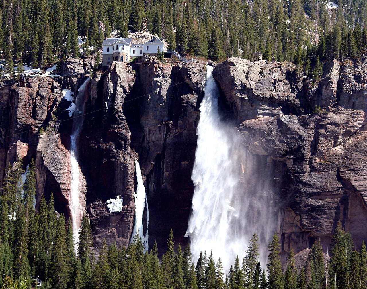
Photo: Terry Foote · CC BY-SA 3.0. Image resized for web display.

Start beside the river
The San Miguel River Trail is the simplest option here to shorten as you go. Access points connect it with streets in town, so you can choose a modest out-and-back rather than commit to a distant turnaround. The eastward connection leads toward the Idarado Legacy Trail and its mining-history interpretation.
Keep the route definition clear. The steeper Boomerang connection toward Mountain Village is a different undertaking from following the river through town. For a group with varied walking speeds, agree on a turnaround and meeting place before setting off. That makes a short walk feel intentional instead of like an unfinished longer hike.
Choose between a waterfall and an overlook
Bear Creek begins at the south end of Pine Street and climbs toward a waterfall viewpoint. The official 2026 tourism map lists 2.5 miles each way to that view, or about five miles out and back. Other maps measure shorter trail segments, so use the same endpoint when comparing distance estimates. Plan it as an uphill outing, with time reserved for the descent.
Jud Wiebe is a shorter but steep alternative above town. The usual Aspen Street approach crosses Cornet Creek; another connection uses Oak Street and Tomboy Road. Choose it for an elevated town view when the group is ready to climb. A short loop does not guarantee easy footing or an easy effort.
Official planning information · Additional official guidance · Additional official guidance
Understand the Bridal Veil approach
The county map measures the hike to the bottom of Bridal Veil Falls at 1.12 miles one way with roughly 840 feet of climbing. It rates the trail difficult. That base-of-falls outing is separate from continuing on the road above it. Parking at the lower approach is limited, so have a different activity in mind if the lot is full.
This is a hiking trail: bicycles are prohibited, dogs must be leashed and the published seasonal closure runs December 1 through April 30. Read the county map before departure. Do not convert a photograph of the falls into an assumption that the approach is currently open or suitable for everyone.
Official planning information · Additional official guidance
Save Hope Lake for a separate outing
Hope Lake adds an alpine-lake option outside town. The approach uses the Trout Lake area and Forest Service Road 627, and the tourism board recommends a vehicle with clearance. Check the access road as carefully as the hiking route; the lake itself is not the point to enter as your driving destination.
Avoid combining this with several other major hikes simply because the names fit on one itinerary. Pick one route, download the relevant map and set a turnaround time. Keep a town walk available as the alternative if the road, trail or weather does not support the original plan.
Select bike routes by permitted use
The resort separates mixed-use routes from hiking-only paths. Russell is listed as an easier mixed-use option; Boulevard combines paved and natural-surface sections. Both still require attention to other users and the current map. A trail appearing in a summer brochure does not establish that every type of bicycle is permitted.
Do not book a trip assuming the downhill bike park will be operating. At the November 14, 2026 check, the resort’s page listed it closed with 2027 dates to be announced. Check that page again for the season you intend to visit. Use the published map to distinguish cross-country access from bike-park operations, and arrange rentals or transport only after the route is settled.
Keep planning
More ways to explore
Skiing & winter recreation
Plan ski days, Nordic outings and time off the slopes with the right transportation and current conditions.
Read the guideRafting & fishing
Choose a guided river trip or a fishing day with realistic access, seasonal planning and current resources.
Read the guideWildlife & fall photography
Plan landscape and wildlife outings around access, changing fall color and the time each location deserves.
Read the guideYour Open Road Bucket List
Save a place. Plan the trip.
0 saved stops in this browser.
Sources, photo credits and map details
Planning information checked November 14, 2026. Follow the linked operators and land managers for changes.
- tellurideskiresort.com · bike park
- trails.colorado.gov · bear creek 13578
- www.openstreetmap.org
- www.openstreetmap.org
- www.openstreetmap.org
- www.openstreetmap.org
- www.sanmiguelcountyco.gov · Bridal Veil and Ingram Creek Trails Map PDF
- www.telluride.com · bear creek falls trail
- www.telluride.com · bridal veil falls trail
- www.telluride.com · hope lake
- www.telluride.com · jud wiebe trail
- www.telluride.com · san miguel river trail
- www.telluride.com · telluride and mountain village 2026 summer maps.pdf
- www2.census.gov · 2025 gaz place 08.txt
Photo credits
- Photo: Terry Foote · CC BY-SA 3.0. Image resized for web display.
The destination map pin represents the town area. It is not a trailhead, parking entrance or route instruction. Specific attraction points are recorded only when a source can be verified. Use the official access information before setting out. OpenStreetMap-derived attraction points, where used, are credited to OpenStreetMap contributors under the ODbL.
