
Pikes Peak region
Wildlife & Fall Photography Around Colorado Springs
Colorado Springs offers several photographic landscapes within the same region: red sandstone, wetlands, historic streets and higher forest. Pick one setting for the outing and give it time. Wildlife sightings and fall color are opportunities, not items that can be guaranteed on a schedule.
Saved in this browser. View your list in the Visitor Center.
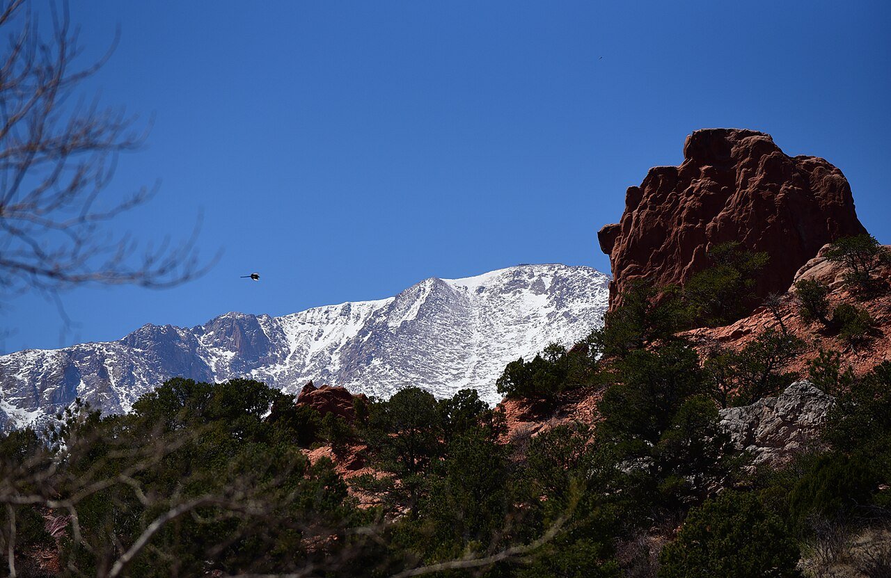
Photo: Staff Sgt. Amber Grimm / U.S. Air Force · Public domain (U.S. federal government work). Image resized for web display.


Fountain Creek for quieter wildlife observation
The nature center's wetland and cottonwood setting is a useful place to watch carefully rather than cover distance. Walk slowly, pause where you can see across habitat edges and use binoculars or a longer lens. The nature-trail area does not allow dogs, bicycles or fishing, which makes it important to choose the correct part of the regional park. Stay on the trail and let the animal remain the one deciding how the encounter unfolds.
Use sandstone as the subject
At Garden of the Gods and Red Rock Canyon, a strong image does not require wildlife or a dramatic sunset. Look at the relationship between rock faces, vegetation and the distant mountain backdrop. Try one broad composition and one closer detail instead of moving continually to the next overlook. Keep equipment out of shared paths, and use the designated trail system rather than climbing onto fragile terrain for a cleaner foreground or a few feet of extra height.
Official planning information · Additional official guidance
Go higher for a different fall landscape
Mueller's forests, meadows and granite outcrops offer a different scene from the city below. Color and weather can vary over a single outing, so keep the route flexible and bring a layer for long stops. Follow the park's trail rules and leave pets off the trails. Rather than promising a specific peak weekend, use recent local conditions to decide whether the day is better for leaves, woodland detail or a view of changing weather over the surrounding country.
Make room for the city’s history
Old Colorado City and downtown's historic streets can carry a photography day when the mountains are obscured. Architectural detail, signs and the way a street slopes toward the landscape often tell a clearer story than another distant panorama. Respect private property and people using the street, and keep any tripod out of the way. For wildlife, never trade distance for a close portrait. A smaller subject in its surroundings can make a more informative photograph and leaves the animal undisturbed.
Read our Old Colorado City guide for a closer look at the visit, current planning considerations and accessibility.
Keep planning
More ways to explore
Skiing & winter recreation
Plan winter outings around Colorado Springs, with activity choices, seasonal access and practical resources.
Read the guideHiking & biking
Explore hiking and biking around Colorado Springs, with route choices, access details and official trail resources.
Read the guideRafting & fishing
Plan rafting and fishing near Colorado Springs, with river choices, seasonal access and current planning resources.
Read the guideYour Open Road Bucket List
Save a place. Plan the trip.
0 saved stops in this browser.
Sources, photo credits and map details
Planning information checked November 14, 2026. Follow the linked operators and land managers for changes.
- CPW: Mueller State Park
- Garden of the Gods park rules
- El Paso County: Fountain Creek Nature Center
- Colorado Springs Pioneers Museum: A Brief History
- www.fs.usda.gov
- www.openstreetmap.org
- www.openstreetmap.org
- Red Rock Canyon Open Space
- www.wikidata.org
- www.wikidata.org
- www.wikidata.org
- www.wikidata.org
- www.wikidata.org
- 2025 Census Gazetteer: Colorado places
Photo credits
- Photo: Staff Sgt. Amber Grimm / U.S. Air Force · Public domain (U.S. federal government work). Image resized for web display.
The destination map pin represents the town area. It is not a trailhead, parking entrance or route instruction. Specific attraction points are recorded only when a source can be verified. Use the official access information before setting out. OpenStreetMap-derived attraction points, where used, are credited to OpenStreetMap contributors under the ODbL.