
Yampa Valley
Wildlife & Fall Photography Around Steamboat Springs
Steamboat gives photographers several distinct landscapes: the river through town, wooded slopes, open ranch country and the lakes of North Routt. Choose a setting before choosing a long driving loop. A shorter route with time to watch the light usually produces a more coherent day than racing between every fall-color location on a map.
Saved in this browser. View your list in the Visitor Center.
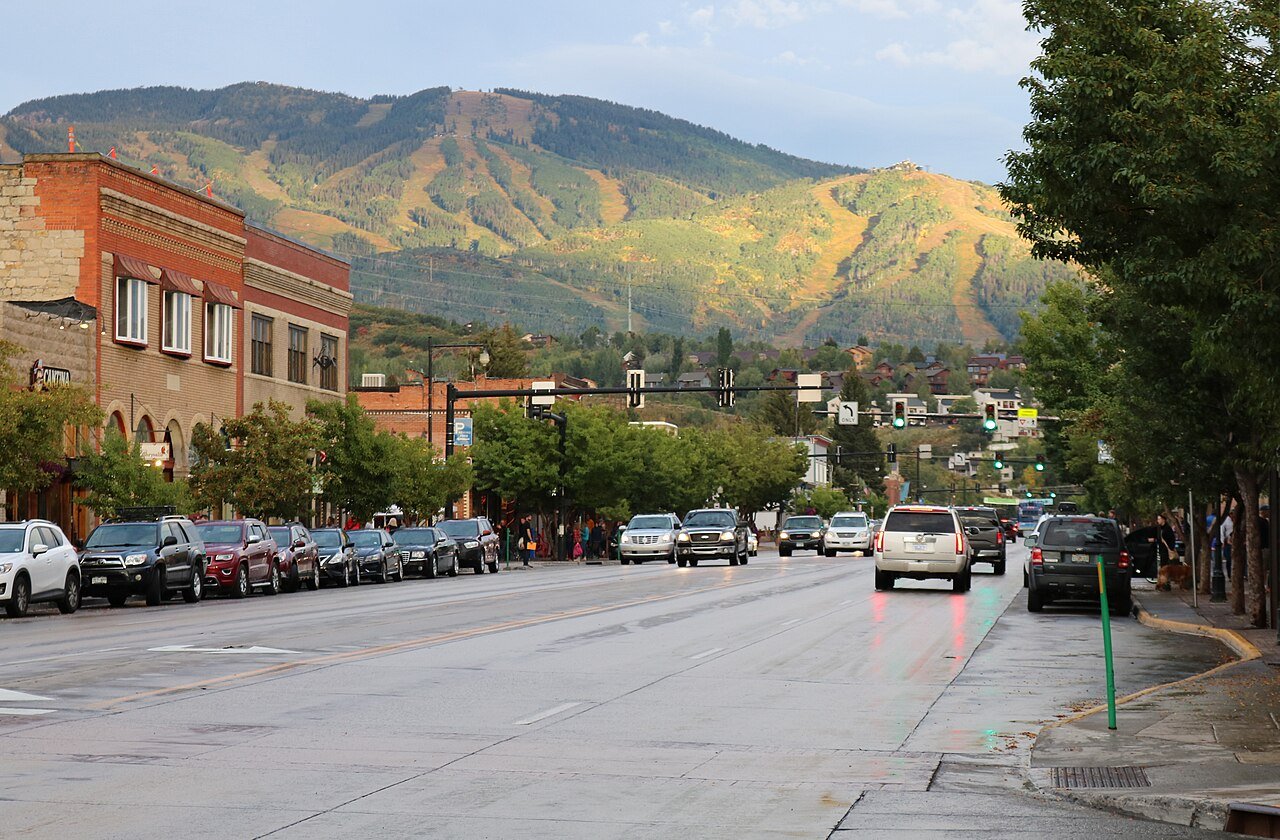
Photo: Jeffrey Beall · CC BY 4.0. Image resized for web display.

Begin with the river and a town view
The Yampa River corridor gives you water, vegetation and a sense of the town in the same outing. Walk a manageable section of the Core Trail and look for compositions from authorized public access. Bridges and shared paths need to remain clear, especially when visitors stop at the same view.
Keep the distinction between river access and photography access in mind. A good view from a public path does not give permission to enter a private bank or a closed river reach. If a scene depends on leaving the route, look for a different angle. The town setting is worth including alongside mountain photographs because it shows how the valley is actually experienced.
Official planning information · Additional official guidance
Use Fish Creek Falls for more than a distance goal
The overlook and lower-falls area can provide a focused photo outing without committing to the longer Upper Fish Creek Falls hike. Decide which route fits your mobility and available light, and use the official visitor description to avoid confusing the two destinations. Wet, icy or snowy surfaces can change what is practical.
Try a wider composition that includes the surrounding landscape as well as a closer view of the water. Keep equipment and bags out of the path, and do not step beyond barriers to remove another visitor from the frame. If the light is not what you expected, the forest and trail setting may offer a better subject than waiting for one particular waterfall image.
Official planning information · Additional official guidance
Build a fall drive around conditions
Local fall itineraries include the broader Steamboat and North Routt landscape, but color varies across elevations and from year to year. Keep more than one possible stop in mind, and check the weather and roads before committing to a farther excursion. A scenic route may involve more exposure or a different surface than the principal highway into town.
Plan stops where parking is allowed and fully clear of traffic. Open ranch land often has fences and private property boundaries that remain important even when the view looks inviting. Include a few broad landscape images rather than making every stop depend on standing inside an aspen grove. A storm, bare branch or patchwork of colors can tell the story of the season as well as peak foliage.
Official planning information · Additional official guidance · Additional official guidance
Respect wildlife closures as part of the landscape
Emerald Mountain’s BLM closure south of Ridge Trail runs from December 1 through June 30 to protect wintering and calving elk. That restriction is a practical reminder that recreation and habitat share the valley. Use the current map and remain outside closed areas even when no animal is visible.
Watch wildlife from a distance with binoculars or a longer lens. Do not feed or follow an animal to improve a photograph, and move back if its behavior changes because you are there. Keep expectations realistic: a good wildlife outing may produce no close photographs. The surrounding habitat is still a worthwhile subject and often makes a more informative image than a tightly cropped animal portrait.
Official planning information · Additional official guidance
Match North Routt and garden stops to the season
Steamboat Lake provides a separate northern landscape with water and mountain context. Check current park access and allow enough time for the return drive before waiting for late light. Yampa River Botanic Park offers a more compact seasonal setting in town, but it closes for winter. Verify its opening period rather than assuming a garden photographed in summer is available during a late fall visit.
Official planning information · Additional official guidance
Keep planning
More ways to explore
Skiing & winter recreation
Plan winter outings around Steamboat Springs, with activity choices, seasonal access and practical resources.
Read the guideHiking & biking
Explore hiking and biking around Steamboat Springs, with route choices, access details and official trail resources.
Read the guideRafting & fishing
Plan rafting and fishing near Steamboat Springs, with river choices, seasonal access and current planning resources.
Read the guideYour Open Road Bucket List
Save a place. Plan the trip.
0 saved stops in this browser.
Sources, photo credits and map details
Planning information checked November 14, 2026. Follow the linked operators and land managers for changes.
- CPW nature viewing
- Steamboat Lake recreation and track chair
- BLM Emerald Mountain and seasonal closures
- COtrip live road conditions
- www.fs.usda.gov
- www.openstreetmap.org
- www.openstreetmap.org
- Steamboat autumn activities
- Steamboat hiking options
- Fish Creek Falls route choices
- Steamboat autumn routes
- Steamboat Springs city trails
- City Yampa River information
- www.wikidata.org
- www.wikidata.org
- www.wikidata.org
- www.wikidata.org
- www.wikidata.org
- Yampa River Botanic Park visitor guide
- 2025 Census Gazetteer Colorado places, internal representative points
Photo credits
- Photo: Jeffrey Beall · CC BY 4.0. Image resized for web display.
The destination map pin represents the town area. It is not a trailhead, parking entrance or route instruction. Specific attraction points are recorded only when a source can be verified. Use the official access information before setting out. OpenStreetMap-derived attraction points, where used, are credited to OpenStreetMap contributors under the ODbL.