
Roaring Fork Valley
Wildlife & Fall Photography Around Aspen
Aspen’s strongest photography days do not need to be a race between famous viewpoints. Choose one valley or trail, allow time for changing light and keep a second option for weather or access. Fall color varies with elevation and conditions, while wildlife sightings are never guaranteed. A good plan focuses on the setting and gives animals the space to stay there.
Saved in this browser. View your list in the Visitor Center.
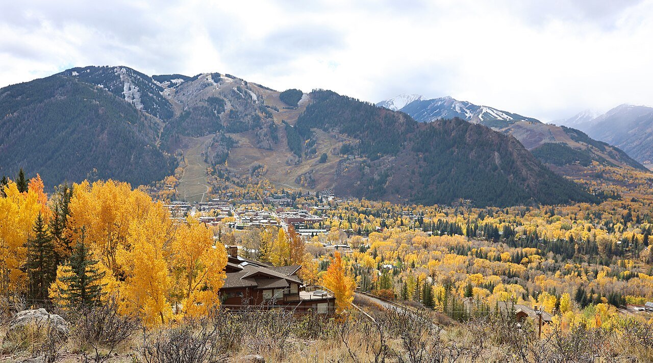
Photo: Jeffrey Beall · CC BY 4.0. Image resized for web display.

Make the Maroon Bells visit deliberate
For the familiar lake-and-peaks composition, plan the required access before choosing the rest of the day. A sunrise idea is not useful without a valid way to reach the scenic area at that hour. Check the current shuttle, parking and seasonal access arrangements, then decide how long to spend by the lake or on a legal trail.
The classic view is only one possibility. Look for smaller compositions in trunks, reflections and changing weather without stepping into vegetation or blocking the path. If the scene is busy, wait or move to another permitted viewpoint. A photo is not improved by pushing into a closed area, and the surrounding landscape offers more than a single postcard angle.
Official planning information · Additional official guidance · Additional official guidance
Use the valley for a slower outing
The Rio Grande corridor gives a different perspective from the high peaks: river light, vegetation, bridges and the relationship between town and landscape. Choose a section with an easy return and keep equipment clear of cyclists and pedestrians. It is a useful alternative when a long high-elevation drive would consume the best light.
Castle Creek and Ashcroft add historical buildings and mountain context. Check the site’s visiting arrangements, stay outside closed structures and use the established routes. Historic buildings can anchor a composition without treating them as props to climb on. A short walk with time to observe can produce a more coherent set of images than a rushed drive through several valleys.
Official planning information · Additional official guidance
Read our Ashcroft Ghost Town guide for a closer look at the visit, current planning considerations and accessibility.
Watch wildlife without changing its behavior
North Star protects a river and wetland setting east of Aspen. Use the designated trail and observation opportunities, and follow the preserve’s rules, including its restrictions on dogs and bank access. A long lens or binoculars lets you observe without approaching the subject. The East of Aspen Trail and the preserve itself have different permitted uses, so check which side of a boundary you are using.
If an animal changes direction, stops feeding or repeatedly watches your movement, give it more room. Do not feed, call or surround wildlife to arrange a photograph. Leave an escape route and remember that a quiet scene with no animal in the frame is still a worthwhile nature outing.
Official planning information · Additional official guidance · Additional official guidance
Plan for a changing season
Fall color is a moving target rather than a fixed annual appointment. Use current local information, consider more than one elevation, and be prepared for leaves to change or drop after a storm. Independence Pass can provide high-country scenery only while the road is open; it should not become an assumed route home after a late photography stop.
Build the day around a legal parking place and an unhurried return. Keep warm layers and enough time to leave before a seasonal site closes. If snow arrives, shift to town and river scenes rather than forcing the summer plan. Record the trail, valley and season with your photographs so you can find a favorite view on a future trip. A few notes about access and changing light are more useful than a folder full of unnamed locations.
Official planning information · Additional official guidance · Additional official guidance
Keep planning
More ways to explore
Skiing & winter recreation
Plan winter outings around Aspen, with activity choices, seasonal access and practical resources.
Read the guideHiking & biking
Explore hiking and biking around Aspen, with route choices, access details and official trail resources.
Read the guideRafting & fishing
Plan rafting and fishing near Aspen, with river choices, seasonal access and current planning resources.
Read the guideYour Open Road Bucket List
Save a place. Plan the trip.
0 saved stops in this browser.
Sources, photo credits and map details
Planning information checked November 14, 2026. Follow the linked operators and land managers for changes.
- Accessible trails near Aspen
- Aspen Chamber Maroon Bells planning
- Maroon Bells access and permits
- Aspen fall foliage
- Aspen Historical Society Ashcroft
- CPW nature viewing
- Pitkin County North Star rules
- Pitkin County Rio Grande Trail
- CDOT Independence Pass travel information
- www.fs.usda.gov
- www.fs.usda.gov
- www.fs.usda.gov
- Floating North Star access and restrictions
- www.wikidata.org
- www.wikidata.org
- 2025 Census Gazetteer Colorado places, internal representative points
Photo credits
- Photo: Jeffrey Beall · CC BY 4.0. Image resized for web display.
The destination map pin represents the town area. It is not a trailhead, parking entrance or route instruction. Specific attraction points are recorded only when a source can be verified. Use the official access information before setting out. OpenStreetMap-derived attraction points, where used, are credited to OpenStreetMap contributors under the ODbL.