
Summit County and the Tenmile Range
Fall Photography & Wildlife Around Breckenridge
Breckenridge’s fall scenery is available at several scales: a short river walk, a grove above town, a mining landscape or a higher road when it is open. You do not need to hit every famous spot in one outing. Use current color and access information, choose a manageable area and leave enough time to wait for light rather than chase it between parking lots.
Saved in this browser. View your list in the Visitor Center.
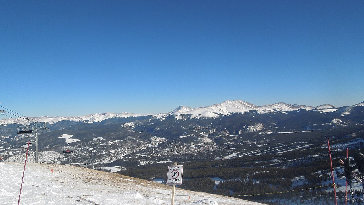
Photo: DReifGalaxyM31 · CC BY-SA 3.0. Image resized for web display.

Check Aspen Alley access before going
Aspen Alley is a popular hiking and biking location, which means the access plan matters as much as the trees. The town introduced fall visitor guidance and shuttle arrangements in 2026. Check the current notice before relying on a particular parking area or assuming a seasonal shuttle is still operating.
Once on the trail, remain alert to other users and keep photo stops out of the moving line. A narrow route is not a good place to spread out equipment or stop the whole group across the path. If the site feels crowded, use a quieter alternative from the current town map. The right photograph does not depend on standing in the most congested grove at the busiest hour.
Official planning information · Additional official guidance
Use town and French Gulch for different subjects
The Blue River and Main Street offer fall context without a long hike, while French Gulch adds mining features and a different relationship between buildings, water and trees. Breck Create’s photography-oriented guide is a useful source of ideas for compositions rather than just a list of destinations.
A short walk can produce a strong set of images if you vary the scale: a broad mountain backdrop, a stand of trees and a close detail. Keep historic structures and machinery outside any climbing or access experiment. Check where the authorized route ends and avoid blocking other visitors while working. A place can remain part of the story without being turned into a prop.
Official planning information · Additional official guidance
Read our Breckenridge Welcome Center & Museum guide for a closer look at the visit, current planning considerations and accessibility.
Keep the high road optional
Boreas Pass is a familiar fall-color idea, but a scenic drive depends on current road and weather conditions. Check the approach before leaving, and do not let a camera plan turn into an unsuitable vehicle route. A fresh storm can change the day quickly, even when the lower town remains pleasant.
Treat color timing as a range rather than a reservation. Current local leaf reports are more useful than a fixed annual peak date, and different aspects and elevations can change at different times. Build a route that allows an easy return and a lower alternative. If the higher view is clouded or the road unsuitable, the river corridor and town details are still worthwhile subjects.
Official planning information · Additional official guidance · Additional official guidance
Observe wildlife without pursuing it
Breckenridge’s forests and wet areas may provide wildlife encounters, but sightings should remain incidental to the outing. Use binoculars or a longer lens, stay on authorized routes and allow animals to move without being surrounded. Do not feed or call them, and do not step off a trail into sensitive habitat to improve an angle.
The most useful photography itinerary is one you can complete comfortably before light and temperature fall. Keep a layer and enough energy for the return rather than using every last minute at the viewpoint. Keep notes about the location, season and route for photographs you want to revisit. That makes it easier to return to a favorite public viewpoint without retracing an entire day of driving.
Official planning information · Additional official guidance
Keep planning
More ways to explore
Skiing & winter recreation
Plan winter outings around Breckenridge, with activity choices, seasonal access and practical resources.
Read the guideHiking & biking
Explore hiking and biking around Breckenridge, with route choices, access details and official trail resources.
Read the guideRafting & fishing
Plan rafting and fishing near Breckenridge, with river choices, seasonal access and current planning resources.
Read the guideYour Open Road Bucket List
Save a place. Plan the trip.
0 saved stops in this browser.
Sources, photo credits and map details
Planning information checked November 14, 2026. Follow the linked operators and land managers for changes.
- Breck Create fall compositions
- CPW nature viewing
- Breckenridge current leaf conditions
- Breckenridge leaf-peeping guide
- Breckenridge accessibility guide
- Breckenridge town and trail maps
- COtrip live road conditions
- www.openstreetmap.org
- Town Aspen Alley access update
- www.wikidata.org
- 2025 Census Gazetteer Colorado places, internal representative points
Photo credits
- Photo: DReifGalaxyM31 · CC BY-SA 3.0. Image resized for web display.
The destination map pin represents the town area. It is not a trailhead, parking entrance or route instruction. Specific attraction points are recorded only when a source can be verified. Use the official access information before setting out. OpenStreetMap-derived attraction points, where used, are credited to OpenStreetMap contributors under the ODbL.